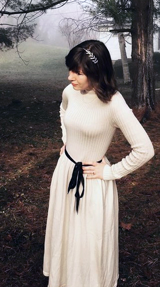
(Young women, of course. But “surfer young women” doesn’t quite carry the Beach Boys allusion.)
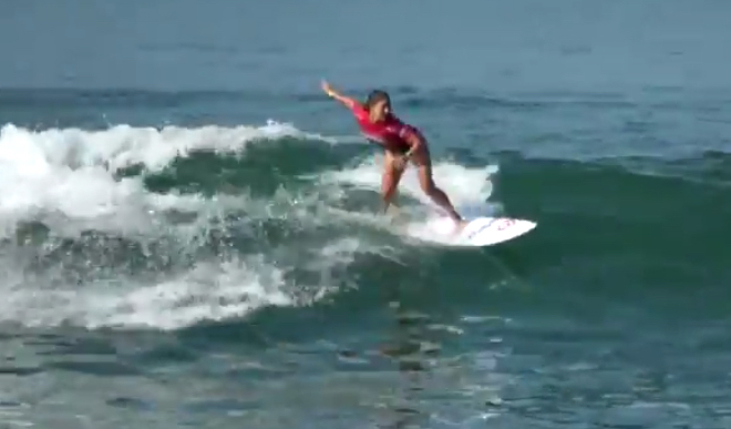
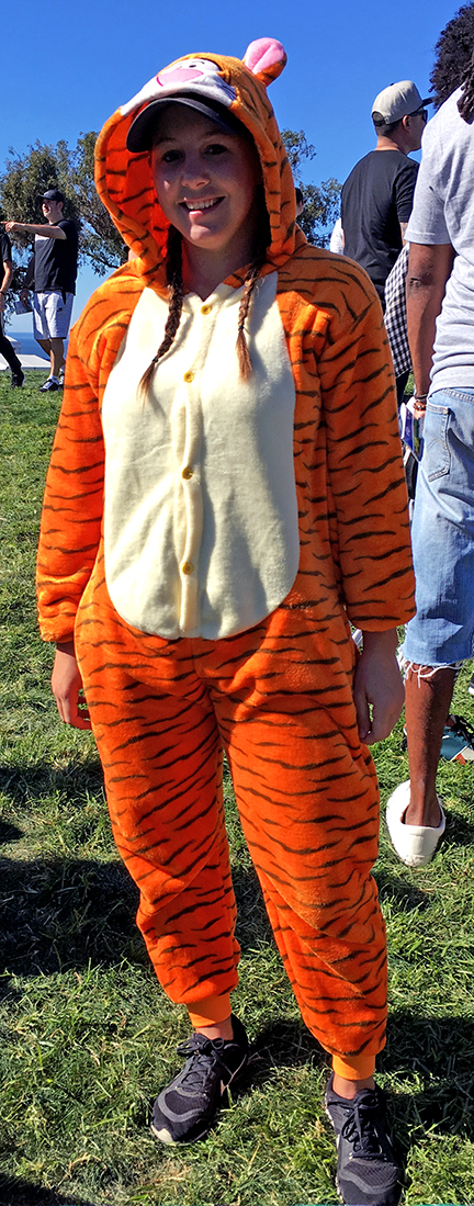
A competitor in the Supergirl Surf Pro event
Back in late July, the Supergirl Surf Pro surfing competition tour came to nearby Oceanside. I showed up somewhat early Sunday morning so that I could get a parking spot. I had tried the previous afternoon and could not find any parking.
The Oceanside event bills itself as “the world’s largest women’s surf event and music festival.” Hard to tell, especially on an early Sunday morning. But this is quintessential SoCal. Surfing alongside an iconic ocean pier with music, booths, an F-16 . . . wait, what? Yes, the Air Force showed up with a pretty large contingent of troops, including a lot of females, even a female brigadier general, and brought along an F-16, for visual effect. It worked.
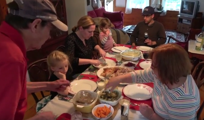
Following a family “Thanksgiving” on Martha’s Vineyard, it was back to classmates and friends Tuesday, June 5. The Andersons brought me to West Yarmouth on Cape Cod, where Marcy Kenah had arranged for a beautiful cottage for us. Some cottage. Lots of room and beautiful setting for 10 of us – Marcy and Larry Kenah, Pat and Tom Sugrue, Shelia and Dan Downey, Debbie and Ken Hamberg, Ed Hattauer, and me.
We celebrated Ed’s birthday and we also had some visitors – Karen Sullivan and Susan and Reid Oslin, all now full-time Cape residents. Richard Sullivan splits time between Mashpee and Holliston, claiming he still needs to work, and was unable to join us.
Gordon, Ann, and the Andersons at “Thanksgiving” in June.
I missed Day 3 of our Class of 1968 reunion at BC. It was a light agenda anyway, but I chose to join the Andersons and visit the Tyras on Martha’s Vineyard. Meredith, Winter, Adeline, and Alice picked me up Sunday morning, June 3, around 9 at BC.
A little bit earlier, I had said goodbye to a classmate whom I came to know at the reunion. Steve Riordan and his wife were heading back down to their home in Maryland. Steve, a big guy, had a career as a Navy aviator and we had bonded somewhat, along with other Navy vets, at the reunion. He was using a cane to assist him in walking, so I was surprised, as I was waiting on the corner for the Andersons, to see him walking toward me from the parking lot. “What are you walking for, Steve?” I asked. He came up to me, slowly, and said, “Couldn’t leave without giving you a hug, man.” That was a very nice way to wrap up reunion.
As we all had not gathered at Thanksgiving time, which had been our practice, for several years, Gordon and Ann were very thoughtful in recreating some of that experience for us. No football, of course, but plenty of turkey and all the trimmings.
The Andersons and I did the traditional nature walk through the nearby Sheriff’s Meadow Sanctuary. Addy did the “walk” this time on her bicycle, while Winter used a skateboard. Meredith, Alice, and I ambulated. We also visited a new brewery on the island. Mad Martha’s offered some choice brew and Vineyard teeshirts. You can see all in the following video.
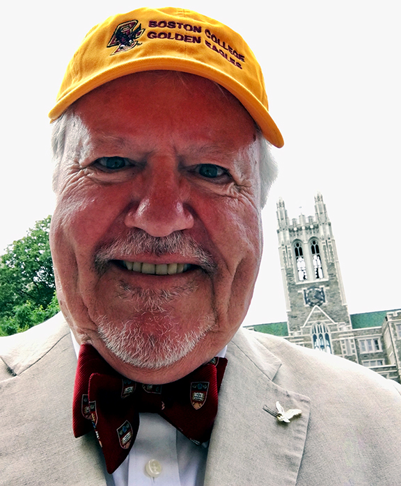
Sunday, June 3, was the 50th anniversary of the graduation of the Class of 1968, my class, from Boston College. I joined close and old friends, as well as some new ones, at BC’s Reunion Weekend, June 1-3.
My new friends came about because of my work, beginning about a year ago, on a blog about what life was like at BC and events in the outside world during 1964-68. You can see much more about the reunion, as well as those lives and times, at ProudRefrain.org. (BC’s fight song, For Boston, contains the line “We sing our proud refrain!”
Our first event was our “investiture” as Golden Eagles, BC’s designation for those alumni who have graduated 50 years or more ago. I became a Twitter micro-sensation when BC tweeted the message at right. BC Alumni San Diego retweeted it, expanding its reach to dozens. 🙂 It was all, of course, due to my bowtie. A somewhat retro version. Indeed, when I received my Golden Eagle pin from William Leahy, SJ, president of BC, he said, “I saw that bowtie! You’re the man!” (I still don’t think he knew who I was, though I had worked at BC 2000-11 and had been in his company several times.)
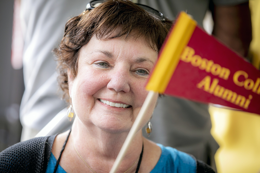
Maureen Burke
One of my most unexpected and enjoyable experiences at reunion was reconnecting two classmates who had long lost touch with each other. Overhearing that Maureen Burke lived in Northern California, I wanted to say hello to a fellow Golden Stater. She mentioned that, following BC, she had been a Navy nurse. “Norfolk, Virginia, 1969.” I said I, too, had been in Norfolk in 1969. “What ship?,” she asked. When I told her I had been on the USS Biddle, she looked startled and said, “I knew someone on the Biddle. His name was Steve.” “Curran?,” I asked. “I think so,” she said. “He’s here,” I replied.
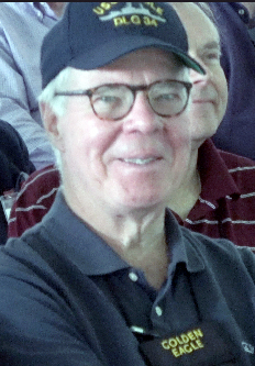
Steve Curran, at the veterans ceremony
(I had known neither Maureen nor Steve, and they had not known each other, while we were at BC. I met Steve Curran for the first time when we became shipmates on the Biddle. We’ve remained classmates, shipmates, and friends since.) I hustled to find Steve and brought him over to Maureen to say hello. They had not been in contact with each other since Norfolk. After meeting Steve at the Officers Club back then, she introduced him to a friend, a physical therapist also at Portsmouth (Va.) Naval Hospital, whom Steve dated during his time in Norfolk. Maureen and Steve each found their chance to get reacquainted, nearly 50 years later, one of the nice features of our reunion. And I thought it was fun to bring it about!
I also enjoyed chatting with current BC students. I shared information about what some of the rules and regs were at BC in our day, what restrictions women students faced, and some of the national and world events that shook our time. “You think things are tumultuous now?!” Just bringing up Martin Luther King’s murder in the spring of our senior year and the assassination of Bobby Kennedy a couple of days after we graduated usually sent jaws dropping. Then add Vietnam, the draft, campus and racial unrest, etc. I appreciated that nearly all of them expressed a high degree of interest.
There are multiple posts about the reunion weekend on ProudRefrain.org, all but one containing video. In this post, I’m including a video that focuses on my close friends and classmates.
I ended up serving on the reunion committee, something usually reserved for “upper-crust” members of the class, i.e., major donors. But, this time, they let at least one of the riff-raff in. It’s traditional that, on the evening of the class party, there is a photo taken of the reunion committee with the president of BC. My sister’s reaction to the photo below? “Gee, guess which one comes from Southern California.”
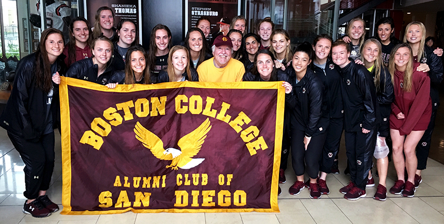
Had a great time last month (March 10) at the BC-San Diego State lacrosse game. #2 BC won, 19-8. But it was meeting members of the team that made it special.
San Diego was in the midst of one of its rare “winter storms,” i.e., rain, so that discombobulated things a bit. Several local alumni showed up, however, as well as members of the Cathedral Catholic girls’ lacrosse team. I had been in touch with BC assistant coach Kayla Treanor via email about a post-game meet-and-greet, but the weather made that unlikely on the field and I certainly expected the team members to want to change from their wet uniforms.
I waited on the sideline for the team to exit the field after the game. I saw them walking toward the gate and then they started running toward me, several of them yelling “Bill!,” “Bill!” (Something the likes of which had heretofore only occurred in my dreams.) Kayla had told them about me getting alumni to the game and that I had put up the two BC banners on the sidelines for the game. They were so appreciative of seeing BC fans and several of them told me how much they liked seeing the banners on “enemy” turf.
They did want to change from their uniforms, of course, so I joined the ton of team parents who had come for the game. It was nice to see how many were there. At least a dozen set of parents, and other relatives. They, too, were very appreciative of our local Eagles coming out.
The team members came out after changing and enjoyed food and beverages provided by the parents. They had pretty much a major tailgate in one of the SDSU athletic buildings. And I got the picture at the top. Me surrounded by 24 lovely young women!
I had the chance to speak with several of them, particularly with senior captain Kaileen Hart and senior Emma Schurr. They were curious about ancient times at BC. I pointed out to the seniors that they would be graduating 50 years after I graduated and that that meant we would always be on the same class reunion schedule. 🙂
I had not known anything about Kayla, the assistant coach, beforehand. In researching, so I would know who she was, I learned that she joined the BC staff last summer. She is a Syracuse legend, graduating in 2016 — 4-time all-America, finalist for the Tewaarton Award (women lacrosse’s Heisman), ACC women’s lacrosse scholar-athlete of the year, and more.
Last week, I joined five classmates for a Boston College winter sports weekend. One or two times a year, there is a weekend when the men’s and women’s basketball teams and men’s and women’s hockey teams all play at home. I had been a regular attendee on these weekends when I lived in New England, but this was the first such weekend for me since moving to California in 2012.
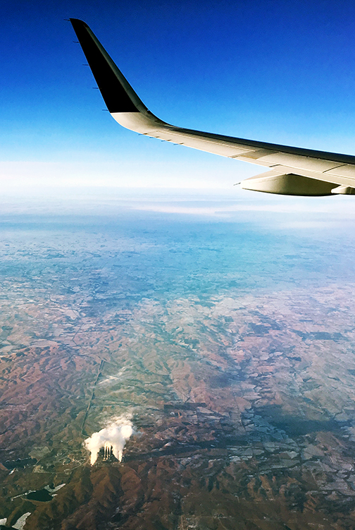
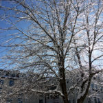
I flew in the night of Wednesday, February 7. On the way, I saw this interesting sight (at right), somewhere over New Mexico, I believe. I came into Boston late enough to miss the snow, but not the cold rain. The next day was bitterly cold, and it helped me realize that it had been six years since I had last experienced below-freezing temperatures.
I stayed at the home of Larry Kenah and Marcy (McPhee) Kenah in Acton. Tom Sugrue drove up from Virginia, arriving in Acton late Thursday afternoon.
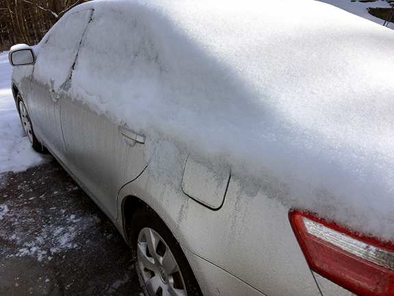
Marcy’s car, encased in ice
Earlier on Thursday, I drove up to New Hampshire to see the Andersons — Meredith, Winter, Adeline, and Alice. First, however, I had to clear the snow and ice off Marcy’s car. While I was doing so, I had a recurrent thought: “Why do people live like this. Don’t they know there is a better place?” It brought to mind, too, a quote of Ronald Reagan’s (which may be apocryphal) — “If the Pilgrims had landed in California, New England would still be wilderness.”
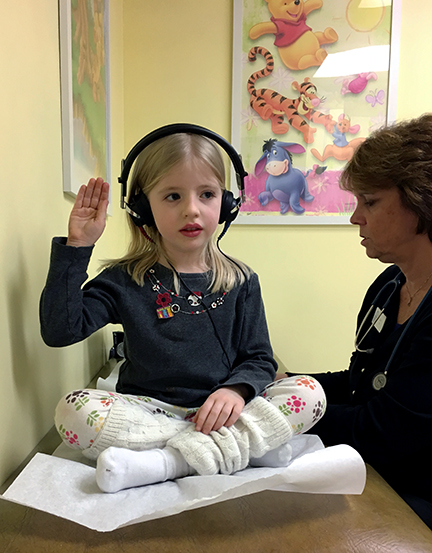
While visiting, and after lunch, we picked Adeline up at school, Rye Elementary, and took her to a well-visit at the doctor’s. Here she is, passing her hearing test. When Winter explained to the girls that Grandpa had to leave, to get back to Acton, two-year-old Alice marched up to me and demanded, “Stay with us! Stay with us!”
A couple of scenes from chilly New Hampshire
An icy tree in Portsmouth
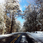
Snowy Love Lane in Rye
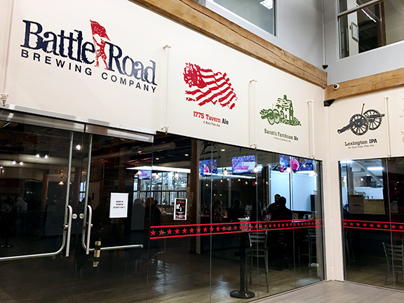
Thursday night, Larry brought Tom and me to a brewpub located in one of the old mill buildings in Maynard that had served as home for Digital Equipment Corporation (DEC), where both Larry and Marcy had worked a number of years ago. Taking advantage of its proximate location, it’s called “Battle Road Brewing Company” and featured various beers with Revolutionary War-themed names.
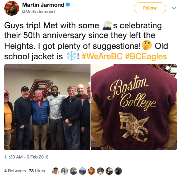
Friday, we joined the rest of the crew: Ken Hamberg and Ed Hattauer, who live in the Boston area, and Dan Downey, who drove up from New Jersey. Before the women’s hockey game that afternoon, we had another appointment in Conte Forum. Tom had read that relatively new Athletic Director Martin Jarmond liked meeting BC alumni from different eras. He sent Jarmond an email, asking if he was interested in getting together with a bunch of Golden Eagles-to-be, and the response was “Yeah!” We met briefly with Jarmond prior to the game, sharing some of our hopes for and concerns about BC athletics.
I was wearing a vintage BC jacket. After we had had a group photo taken at the end of our meeting, Jarmond noticed the back of the jacket and had a picture taken of it. Within less than an hour, he tweeted about our meeting, including the group photo and the photo of the jacket. (I wish I could say the jacket was mine from the sixties, but I had found it in the early 2000s on a rack at a vintage clothing store in Cambridge. $30.)
Here’s a bigger version of the group photo.
L-R: Me, Tom Sugrue, Ken Hamberg, Martin Jarmond, Larry Kenah, Ed Hattauer, and Dan Downey.
Going into the weekend, we figured the most likely win was women’s hockey. The Eagles were ranked 3rd in the country at the time and had beaten their opponent that day, UNH, by an aggregate score of 11-1 in two previous meetings this year. It seemed almost a sure win, while the other teams faced significant challenges. UNH beat BC, 2-1. Of course.
The other teams, though, ran counter to form as well . . . but they won. Men’s hockey scored late in regulation to send the game to overtime, and then scored the game-winner with less than 7 seconds remaining in the overtime period to beat UMass Lowell, 3-2. Men’s basketball held #25 Miami scoreless over the last 6-plus minutes of the game and won, 72-70. Women’s basketball secured only their second ACC win of the season, winning handily over Pitt, 72-61. Pitt and BC were both 2-10 in the conference after that game.
Here’s a brief (5:30) video of scenes from the basketball games and men’s hockey game. (Women’s hockey, despite its exalted status nationally, does not attract fans. It seemed almost disrespectful to show the nearly empty stands and absence of cheering. Building fan support for one of the best examples of athletic excellence at BC is one of the issues we brought before Martin Jarmond, who recognized its importance.)
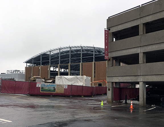
Replacement for the ‘Plex”New Athletics Field House
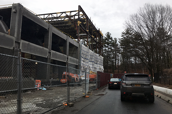
If you have not been to campus lately, there is significant construction going on. (I wonder if there is any class since the fifties that has not seen “significant construction” going on at BC.) The new Connell Family Recreation Center is taking shape, where Edmond’s Hall once stood. On what was Shea Field, the new Athletics Field House, which will provide an indoor practice facility for football and other teams, is also showing its external form.
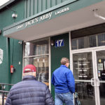
Besides sports — and camaraderie, of course — another focus was food and drink. Among the places: Jack’s Abby, Framingham; City Table in the Lenox Hotel; the Comedor, Newton Centre.
Entering Jack’s Abby
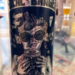
Focal Banger — excellent IPA from The Alchemist in Vermont
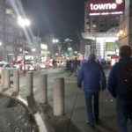
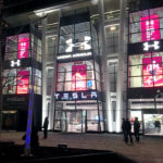
Boylston Street
Under Armour’s store on Boylston Street
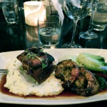
Pork belly and grilled shrimp — on grits — at City Table, Lenox Hotel
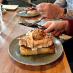
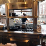
Ed’s french toast at the Comedor, Newton Centre
Comedor’s open view kitchen
Looking out the back of Ken’s place onto Marlborough Street
Here’s a brief video (9 secs) showing lunchtime (about noon) on a Saturday at Jack’s Abby in Framingham. Place was hoppin’ (and I don’t mean just in the beer)!
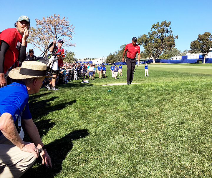
Following his second shot, Tiger Woods moves toward the green on 9S in the final round.
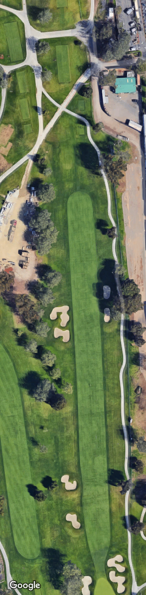
Once again, I spent five days in late January at Torrey Pines Golf Course working as a “hole captain” during the Farmers Insurance Open. It was my 6th year as a volunteer marshal, 3rd year as a hole captain, and 1st year on the 9th hole on the South Course (9S).
As a hole captain in 2016 and 2017, I had been assigned to a 214-yard par-3 hole on the north course and oversaw a crew of 4 marshals. At 614 yards, 9S is 400 yards longer and “my crew” consisted of 19 marshals, swelling to 27 on the weekend, as we were joined by marshals who had worked North #9. (Both courses are used in the pro-am and before the cut, with the final two rounds taking place only on the South Course.)
This year, as you might infer, was harder. It was more difficult physically and more complicated logistically. The job of a hole captain is to help make the experience of each marshal as pleasant and satisfying as possible. You make sure they get lunch, that they have bathroom breaks, that they get to do different jobs on the hole, etc. You also train them, give advice, answer questions. Seven of my 19 marshals were rookies, their first time as a marshal.
Google satellite view of 9S
The physical aspect of 9S that is challenging for a hole captain, as well as for any golfer on the hole, is its length. As a golf challenge, it is not difficult for any reason other than distance. As hole captain, I walked around to each marshal’s post all day. The app on my iPhone reported that on Wednesday, the first day and the pro-am, I took 16,091 steps, covering 6.4 miles, and climbed the equivalent of 15 floors. Numbers were lower in subsequent days, but, in total for the 5 days, I took 56,072 steps, covered 21.8 miles, and climbed 42 floors.
When I wasn’t walking, I was standing. I would estimate that, over the course of the 5 days at the hole, 8-10 hours each day, I sat for a total of less than 30 minutes. This, I guess, is my annual workout.
As with other events at which one works, the focus is more on the immediate, “little” things than the overall event. Marshals seek to manage the fans, providing golfers with quiet and space to do their job well. We also aim to make the experience enjoyable for fans as well, usually by trying to manage those fans who are loud and obnoxious.
The big difference this year was, surprise, Tiger. For marshals, it was not due to his golf, but because his return to golf and to this tournament attracted people. Crowds were not large overall on Thursday and Friday, though his crowd was much larger than anyone else’s. Even though he was not in contention on the weekend (he barely made the cut), the number of people following him was larger than that following Phil Michelson and the leaders’ threesomes combined.
A true fan
But it’s not just the number of people. There are many people who follow Tiger because they want to see him play golf. There are many other people who follow him because of his celebrity. Those people do not seem to care about the etiquette of golf, or much about etiquette at all.
I was not present at the time, but at #9 North on Friday, Tiger’s errant tee shot resulted in a situation that made the local news. His drive went into a section “outside the ropes” and amongst the crowd. Fans surrounded the ball and, despite the efforts of 7 marshals and 4 San Diego police officers, no one would move to permit Tiger to play his next shot. They only moved when Tiger’s caddy shouted out that Tiger would not continue play until everyone moved to the other side of a cart path.
On Saturday, he was to finish his round on our hole, having started on #10. As it would happen later in the day, it would mean maximum crowd. Adjacent to the area where most drives land on 9S, the space for people on the right side of the fairway was narrow, because of fencing around a corporate tent. If Tiger hit one outside the ropes there, we foresaw calamity. As his arrival at the hole approached, more than 20 marshals from holes that had finished regular duties, arrived at 9S to help. I basically just asked them to be a “command presence” alongside the ropes in the landing area. They would also add to the number of marshals and other personnel who could help control the crowd, if we had to move them.
Standing in the fairway awaiting Tiger’s drive, I watched the marshal whose job was to indicate the direction of the drive. His paddle was straight up, Tiger hit, and the paddle then moved up and down repeatedly, indicating straight. Drive landed in the fairway. Problem avoided.
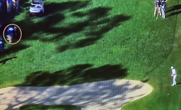
View of Tiger’s second shot on Saturday from blimp. My only appearance on TV. 🙁 I’m in circle at left, in hat with black band.
Sunday was the start of a heat wave, and it also featured Santa Ana winds, the hot, dry, strong winds from the interior. Because a couple of marshals were taken from my hole for other duties, I spent the day on the right side, at the landing area for drives (just about the same spot as in the photo above). Over the course of the day, 7 or 8 golfers’ drives were pushed by winds over the fence around the corporate tent. As marshals, we were to report the fact to the golfer as he arrived and secure a place where he could get a free drop and make his next shot. A PGA rules official would arrive and ask us to confirm the drive had gone over the fence and to indicate about where it had done so. Then we stopped people walking from either direction toward the spot and cleared an area for the shot.
The tournament ended in a tie between Jason Day and Alex Noren. They played five playoff holes Sunday, remaining tied, before darkness forced postponement. Focused on “my job” and really looking forward to getting home, I had left and was unaware of the situation until the next morning when I picked up the paper in my driveway. (Is that old-fashioned or what?) I watched the playoff on TV a little while later and saw Day win by two strokes on the first hole.
This year’s experience was distinctive. More difficult, more intense. In some respects, more interesting. I won’t be a rookie on this hole next year, so I look forward to it all again. Here’s a gallery of images, a mix of screenshots from television and my photos.
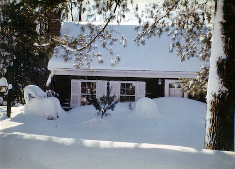
425 Partridge St., Franklin, the day after the blizzard
Forty years ago, light snow started falling on the morning of February 6, 1978, a Monday. I was at a print shop in Boston that day checking a Boston College publication before it was to be printed, with one of our designers. We were inside and not paying attention to the weather. Iconic Don Kent on WBZ radio that morning had predicted “a dusting.”
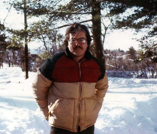
Me, Franklin, 1978, actually before the blizzard
I asked the designer to call the office mid-day (forget why) and she came back saying there was no answer. Tried again a little later. Same thing. I asked her to call the “switchboard” and try to get through that way. (All this seem really ancient yet?) She said the operator told her BC was closed. Closed?! Because of the snow. Snow?! We looked outside and headed home.
I was driving soon-to-be-wife Rebecca’s VW bug and took the designer home to Wellesley. It was not at all easy to drive, but I got her home. And then I made a fateful decision. Should I get on Route 128, the highway, or follow the back country roads, Rte. 16, etc., to Franklin, where we then lived? (Franklin is about a marathon-distance southwest of Boston.) I decided to take the country roads. If I had gone on 128, I might have been stuck there for days, as you’ll see in the video below.
It was now late afternoon and almost dark. I had no way to contact Rebecca to tell her I was coming home, where I was, etc. There were times I remember seeing only white particles streaming horizontally left to right in front of me. The snow and wind made it very difficult to discern the road from what were at times surrounding fields. The VW was very light, but good in snow, because the rear engine was over the drive wheels and gave the car better traction.
At one point, I came around a corner and had to veer off the road to avoid a vehicle stuck in the snow. Bunch of young guys. As I said, the VW was light and they were able to push me back onto the road. Finally getting back to Franklin, there was a lot of snow on the roadways and in the driveway. I just tried to gun the engine and get into the driveway as far as I could off the road. And then we spent the next few days there, occasionally trekking to the small and remote neighborhood store. It was called “Art’s,” or, as locals said, Otz.
This is a video (25:10) of Boston Channel 7’s special on the storm five days later.
Last week, I joined fellow Navy League members, some Navy Junior ROTC cadets, a member of the Naval Sea Cadet Corps, and guests on visits to Navy facilities in Coronado.
Our first visit was to Beachmasters Unit ONE on the Naval Amphibious Base, Coronado. I pointed out to the Commanding Officer of that unit that I had served on that base 1970-71, which was likely before he was born. He was open-mouthed when I showed him pictures of the base at the time.
Dressed for LARC riding
Anyway, after getting a briefing, viewing their vehicles, and handling some of their weapons, we all headed down the Silver Strand to a beach and took a ride. We went out to sea . . . briefly . . . on a LARC (Light, Amphibious, Resupply, Cargo) vessel. As the second wave broke, it washed over the port front quarter of the vessel, over me sitting there, and over my video camera. The camera kinda shorted out shortly thereafter. I used my iPhone during the rest of the day. I still don’t know if the camera, since dried out, will work again. I had detached the battery and misplaced it.
I was able to retrieve the SD card and to download the video files off it, however. I may have lost a video camera, but I got the shot!
In the afternoon, we went on a tour of the USNS Brashear (T-AKE-7), a dry cargo ship, manned by civilians, but doing work for the Navy. Huge ship. According to the Health app on my iPhone, I climbed 14 stories that day and I believe nearly all of them were aboard the Brashear.
You can see highlights on the video below. The young woman in the intro freeze-frame was the Naval Sea Cadet on the tour, a high school senior and a member of the unit supported by our Navy League Council. The Naval Sea Cadet Corps and school-based Navy and Marine Corps Junior ROTC programs are quite popular in Southern California.
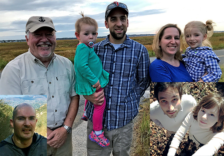
A family photo pulled together from a wide geographic spread. The Andersons and me on Plum Island, Mass. Sam and Julia in Athens, Ohio, and Dillon at Potato Chip Rock, San Diego.Julia, just before the wedding, showing off her hairbrooch.
We have a new member of the family! After years of auxiliary membership, Sam Merten is now official. Julia and Sam were married in a civil ceremony on December 1 in Athens, Ohio. (That’s their wedding “selfie” at lower right in the photo above.) It was the 10th anniversary of their first date, as freshmen at St. John’s College, Annapolis, Md. Sam is finishing up his doctorate in computer science at Ohio University. The two of them, as you read this, are either in Paris or Berlin, the twin destinations of their honeymoon.
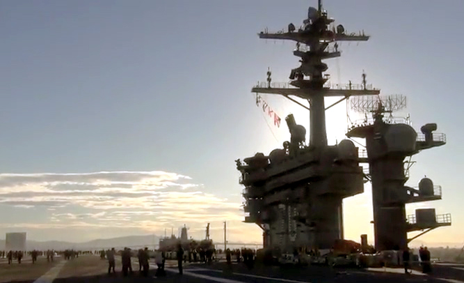
Starting off, I’m going to break the calendar rule, but it’s okay since it was too late for last year’s note and I didn’t post it on my blog until January. On December 29, I went to sea for the first time in 45 years . . . voluntarily.
I joined fellow Navy League members on a “family and friends cruise” aboard the USS Carl Vinson (CVN-70). These cruises permit loved ones to spend time with their Navy family members before an extended deployment. While it was exciting to see helos and jets in action, I was particularly struck by how I felt doing what I had done for so many hours at sea . . . watching the wake of the ship and the ocean going by. In somewhat of a trance doing so, I was startled when a young sailor, passing by, asked, “Bring back memories, sir?” Sure did. There’s a great video of the day, if I say so myself, on the blog.
We did something different this year for the annual visit by the Andersons. I met them in San Francisco and we spent a few days in the Bay Area, where we had lived for a dozen years, 1984-96. Meredith was able to show her family many favorite spots in Berkeley, including Mr. Mopps toy store and School of the Madeleine, where she and Dillon attended school. Winter and Adeline joined me at the Lawrence Hall of Science on the Berkeley campus, with one of the great views of the Bay. We visited Muir Woods and enjoyed the obligatory, and wonderful, view of the Golden Gate from the Marin Headlands.
Here’s a gallery of photos from the trip.
We had intended to drive down Rte. 1 along the coast, but the heavy rains that winter had dislodged a bridge and caused a landslide that closed the road for many miles. Back south in San Diego, we went to the beach (duh) and the Zoo.
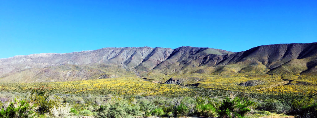
Out in the desert, the rains had also brought about a superbloom of desert wildflowers. And that brought a super-number of people out in February and March. We organized a BC Alumni San Diego tour a little ahead of the mass turnout. More complete post, with video.
Asilomar scene
In April, I went up north again. I attended a California State Parks conference at a place called Asilomar. I knew very little about it beforehand, but it turned out to become one of my favorite places in California. I mean, location on the western side of the Monterey Peninsula makes it special right away. But Asilomar is a hotel and conference center run by State Parks and is a former YWCA campground built in 1913, with craftsman-style buildings designed by Julia Morgan, a wonderful and too often overlooked architect of the early part of the 20th century. Among other things, she designed La Cuesta Encantada, more popularly known as Hearst Castle. More complete post, with video.
In July, I joined volunteers helping out in the annual sheep count in Anza-Borrego Desert State Park. Instead of spending 3+ days monitoring sheep, however, I was there for one morning and at one of the easier locations to access. Well, “easier” means different things to different people. The hike out to Palm Canyon is about 1.5 miles. I did fine going out in the early morning. It was relatively cool and I managed getting over the rocks when necessary. Coming back out, midday, when temps were 100+, I hit a wall. I must have looked like someone in Lawrence of Arabia. Just slogging along, trying to put a foot in front of the other. Back at the count headquarters, a Park Ranger said she was going to keep her eye on me, because I looked peaked. I felt it, too. But I got to see almost 20 sheep and some up close, like the ram in photo. More complete post, with video.
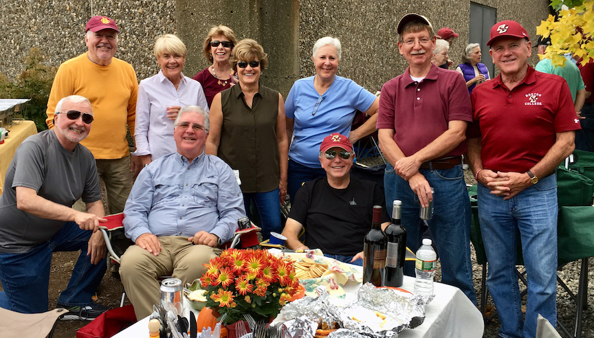
My annual trip back East was in October. Joined my favorite BC classmates for the Virginia Tech game, which was a downer. But, after that game, the Eagles won 5 of their last 6!
Golden Eagles and spouses tailgate in style.
This is our Golden Eagle year. In June, we will mark — and celebrate — the 50th anniversary of our graduation from BC. I have a blog up for that as well at ProudRefrain.org.
The year came to a somewhat dramatic close, as I was ordered to evacuate my house because of the Lilac Fire, which started on December 7. Along with Baxter and Boo, I spent that night in a Red Cross shelter in Escondido. Several friends were kind enough to offer me space, but this dog and cat complicate things. 🙂 All in all, I was inconvenienced but unharmed and it was a valuable, though unwelcome, experience.
Wishing you a very merry Christmas and that twenty-eighteen is keen.


")
")

")
")
")

")