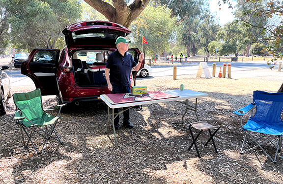
As my car was to carry the “stuff” for the tailgate Saturday afternoon, there was room for only one passenger and Tom Sugrue volunteered to help set up the table, chairs, etc.
We arrived at the entrance to the preferred tailgate area at 2 pm, 30 minutes before it was to open. We were the first car in line. And soon after the gate opened, we were ready.
Tom at the tailgate, ready for more!
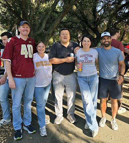
The rest of the Moss Beach group was to arrive via Uber a bit later in the afternoon. Meanwhile, we were soon joined by Lissa and Brian Tsu from the San Diego alumni chapter, Chris Lamb from the Bay Area, and an increasing number of BC alumni.
L-R: Bill Connors ’00, Alyssa Connors, Brian Tsu ’00, Lissa Tsu ’00, and Diego Garcia.
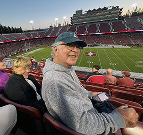
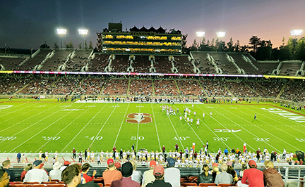
Too soon, it seemed, it was time to go to the game. As mentioned in the first post, our seats were pretty good. Here’s the view.
The performance by the Eagles didn’t match the quality of our seats. Tied at halftime, BC didn’t score again and allowed Stanford 10 second half points to give the Cardinal their first win of the year, 30-20.
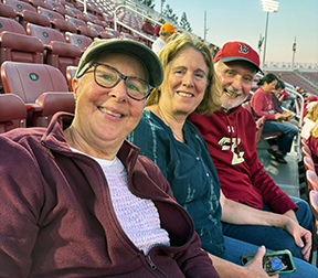
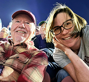
Here are some snapshots in the stands.
Marcy, Jackie, and EdShelia and DanLissa and me, and Tom Sugrue right behind us.
A great day. A disappointing evening.
The drive home
Heading south on the 5. Still straight.
The trip back to Fallbrook took two hours less than the drive north. Two basic reasons: it was a Sunday and, when I got to the LA area, I took the inland freeways instead of the coastal ones.
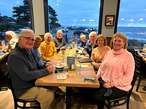
Friday night before the BC-Stanford game, the crew that stayed in Moss Beach went out to dinner at local favorite, the Moss Beach Distillery Restaurant.
L-R: Dan Downey. Shelia Downey, Me, Ed Hattauer, Marcy Kenah, Tom Sugrue, Pat Sugrue, and Jackie Hewitt.
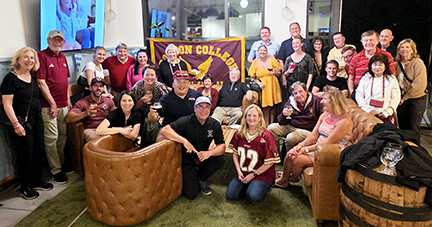
Meanwhile, in Menlo Park.
Members of the San Diego chapter, as well as some from LA, Orange County, and San Francisco, gathered Friday evening in Menlo Park for pre-gaming.
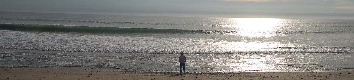
The 7:30 pm kickoff time for the game meant that tailgating could start after 2:30 pm on game day. So that left some time Saturday morning for a walk around the local area, particularly the seashore.
Most of the others had gone earlier, so I was on my own. The Fitzgerald Marine Reserve is a San Mateo County protected area. The coast there is primarily an inter-tidal area, where the difference between low and high tide creates a distinctive environment for algae, crabs, sponges, seastars, mollusks, and fish.
Throughout our time in Moss Beach, we would see flocks of birds, mostly brown pelicans, flying north and south along the coast line. Soon after entering the marine reserve and standing on a bluff, I was lucky enough to view such a flock flying north below me.
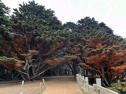
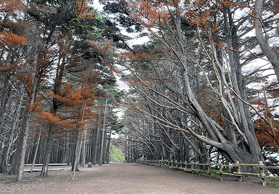
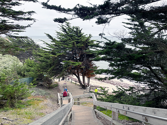
Plant life, most notably trees, was also distinctive in this environment. The local unofficial name for the area is the “enchanted forest.” Here are some views.
And the stairway to Seal Cove Beach. Didn’t take it.
I had been to Stanford Stadium twice before, but both times were in the 20th century. Went to a Big Game (Cal-Stanford) and to an exhibition game there between the then-Oakland Raiders and New England Patriots. Son Dillon, big Pats fan, joined me for the latter game.
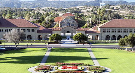
I had not experienced the Stanford campus, however. Had seen lots of pictures of the buildings and knew the campus was huge, but I wanted to spend time there walking around and also to scope out the locations near the stadium where we wanted to have our tailgate.
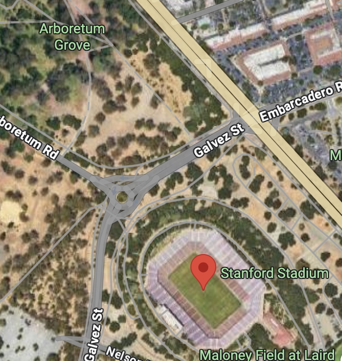
I went to the campus, about a 45-minute drive from Moss Beach, Friday morning and parked at the Visitor Center, where I picked up a map. My first walk was to the stadium and, more importantly, the Arboretum adjacent to it. I had purchased a parking pass in that location.
Instead of paved parking lots, the stadium is surrounded by groves of trees. Tailgaters park among the trees, which provide shade. It’s just a much more pleasant environment for a tailgate than an open field or parking lot.
After getting some eyes-on orientation to the tailgating location, I headed to the academic area of the campus. I took just under 11,000 steps that day, which an online calculator gauged to be just under five miles.
Stanford did not begin its “autumn quarter” until more than a week after the BC game, so the students on campus were primarily grad students. And while the campus is open to automobile traffic quite extensively, based on the number of bicycles I saw being ridden or in racks, it’s a bike-centric campus.
Official University logo
The Stanford logo is a cardinal red “S” with a green sequoia tree superimposed on it. After walking around that campus, I get it. Trees are plentiful and are somewhat honored with arboretums and identified “groves.” (The “Stanford tree” that you see with the Stanford student band is the mascot of that band, long recognized for boisterous and, in the opinions of quite a few, offensive behavior. The University has no official mascot.)
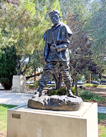
Below is a gallery of scenes from my walkabout. Clicking on any of the thumbnails will present larger image.
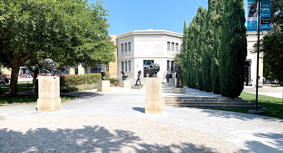
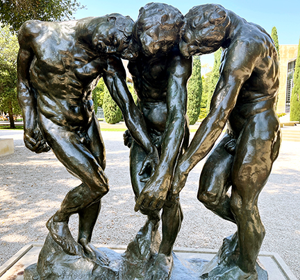
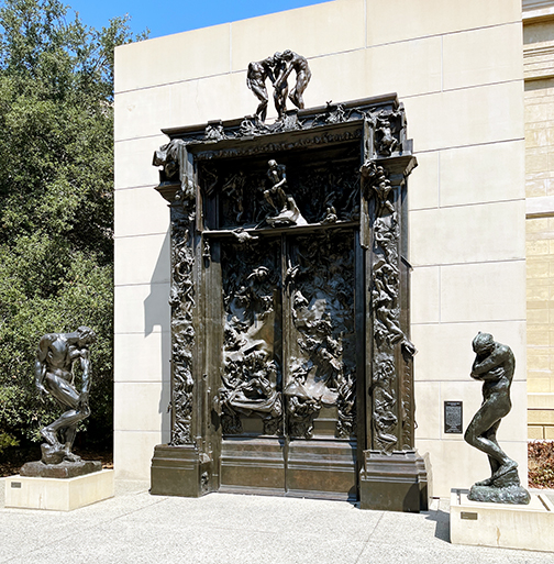
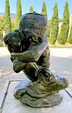
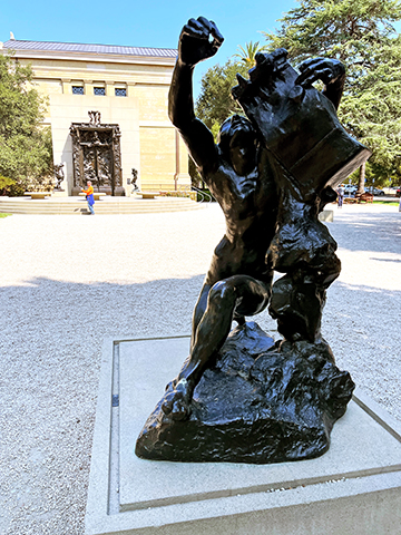
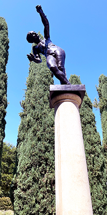
A specific target of the walkabout was the Rodin Sculpture Garden, with 20 of the noted sculptor’s most famous sculptures on display among cypress trees and gravel paths on an acre of land.
Entrance to the Rodin Sculpture Garden
Here’s a slideshow of some of the sculptures in the garden.
I wore a somewhat bold BOSTON COLLEGE shirt on my tour and ran into several fellow alumni doing the same walkabout as I was. At one point, I came upon an older gentleman who asked me to take a picture of him and his daughter, which I did happily. He told me she was on campus to begin her doctoral program at Stanford. She was aware that BC and Stanford were to play the next day and wished us luck.
I had decided that I would drive up to Stanford for the long weekend. It would enable me to bring some of the “infrastructure” for the tailgate, e.g., a folding table, couple of camp chairs, and a large cooler for food and drink.
I had made the drive to SoCal from the Bay Area and back several times when we lived in the East Bay a few decades ago. Most recently prior to this drive north, I had done it in 2017, picking up my daughter, son-in-law, and two little granddaughters at SFO and spending a few days showing them where their mother had lived, gone to school, etc.
I left at 7 am Thursday, two days before the game, figuring most of that day would be on the road. The drive was going to be just under 500 miles and GPS said it was going to take about eight hours. I also planned to stop twice at Costco, one just north of LA and the other in Gilroy, for restroom and fuel stops.
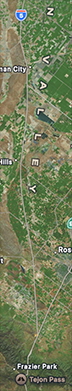
GPS also advised me to take the 5 (Interstate 5 to non-Californians) through LA. I knew most of the trip was going to be on the 5, the main north-south highway through California’s Central Valley. Was a little surprised GPS advised getting on it south of LA.
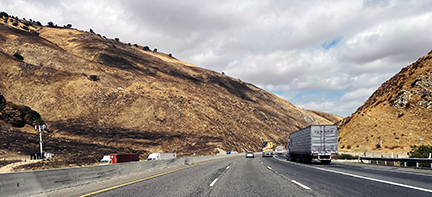
It wasn’t until I was stuck in morning bumper-to-bumper commute traffic that GPS finally advised an alternate route. It took me off the freeway into some of the least attractive areas of LA and then up onto the 210 to the east of LA through Pasadena.
There I was able to see some of the burn scars resulting from the fires back in January, as shown here.
Burn scars at upper left near Altadena.
The first stop at Costco was 90 miles from my house. It took me three hours to get there.
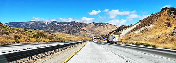
Going through “the Grapevine” north of LA on the 5 always seems interesting. Grapevine is not a formal name. There are various local references to grapes and grapevines, but it is where the 5 stretches from Santa Clarita, just north of LA, to California’s Central Valley.
The freeway goes through the Tehachapi Mountains, reaching an elevation of 4,144 feet at the Tejon Pass.
The Grapevine. Again, burn scars ahead on the left.
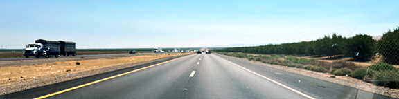
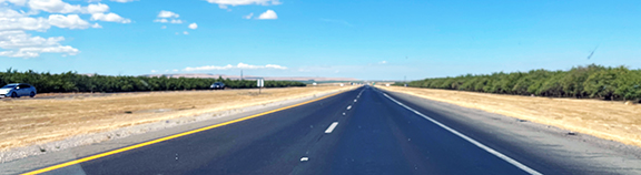
Once through the Grapevine, the Central Valley stretches ahead to the horizon and the 5 is flat and straight.
The straight 5.
For more than 100 miles, the only change in direction of any note is changing lanes on occasion.
On my second stop at Costco, in Gilroy, I picked up some of the local produce from the “Garlic Capital of the World.” Just garlic bulbs, not the garlic ice cream.
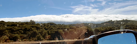
The weather forecast for Moss Beach and Half Moon Bay had changed significantly just days before. Instead of clear skies and high temperatures in the low 70s, the forecast was for the marine layer to persist throughout and for high temperatures in the low 60s.
From the road just east of the bay, evidence of the marine layer’s “cat’s paws” was pretty strong.
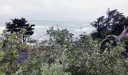
The last of the group to arrive at our Airbnb around 5 pm, I enjoyed the view and the chance to rest.
When it was announced that Boston College would play new ACC member Stanford in football September 13 this year, San Diego Eagles were interested in the opportunity to see their football team play on the West Coast for the first time in 12 years.
To assist, I contacted the Stanford ticket office in the spring to inquire about group discount tickets through them. We decided to set aside 50 seats on the upper level of the visitor side of the stadium at midfield ($40) and another 50 in the adjacent section ($25). They went on sale May 1.
We shared information on the tickets with members of the San Diego chapter, as well as alumni chapter leaders in Orange County, LA, and San Francisco.
Long story short, later in mid-summer we expanded the number of tickets assigned to us at midfield and ultimately sold 120 there.
I had purchased 10 tickets and transferred them via the web to nine classmates and partners who planned to head west for the game, replacing the usual game at BC for which I would travel east to join them. That was a nice change for me.
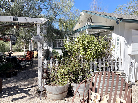
In the last two months, I used Airbnb twice. I had never used it previously. They were for practical reasons, not vacation, and the locations were unconventional or, perhaps in some minds, “funky.”
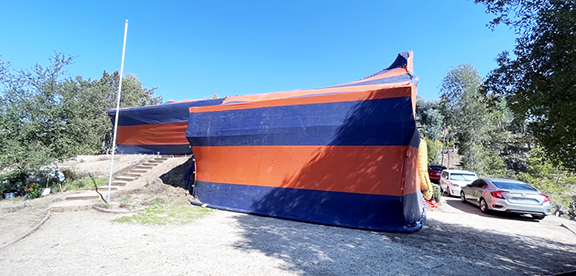
The first location was seven minutes away from my house. With the Andersons on vacation in New England in mid-October, it seemed the right time to have our house fumigated for termites, as had been suggested by pest control firms. That’s the tenting you see, usually on houses going up for sale. For two days and nights, the house would be inaccessible. This was the view when I left.
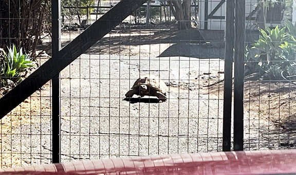
I chose a place nearby, but not just for location. The site was described as a mini-farm, with various animals about. I texted the owner when I was about to leave and she replied that I should text her when I arrived at the gate, because the tortoise was out. I wasn’t totally sure I was at the correct location until I saw this.
The owner told me the tortoise, King Tut, was the animal that tried most often to escape, and sometimes was successful. Her phone number was painted on his shell.
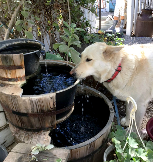
Pepper drinking from the fountain outside my door.
When I was introduced to Pepper, I was told she was “the guests’ dog.” She liked to spend time with visitors, the owner said. Indeed, Pepper spent a lot of time sleeping just outside my door and always greeted me when I arrived at the farm.
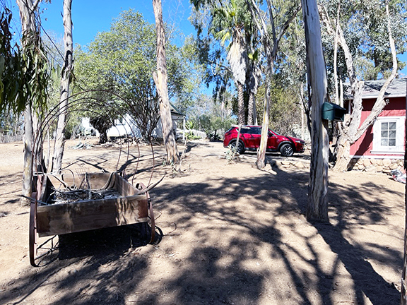
My red Mazda at the farm.
My residence was at right.
Here’s a gallery of other animals on the property.
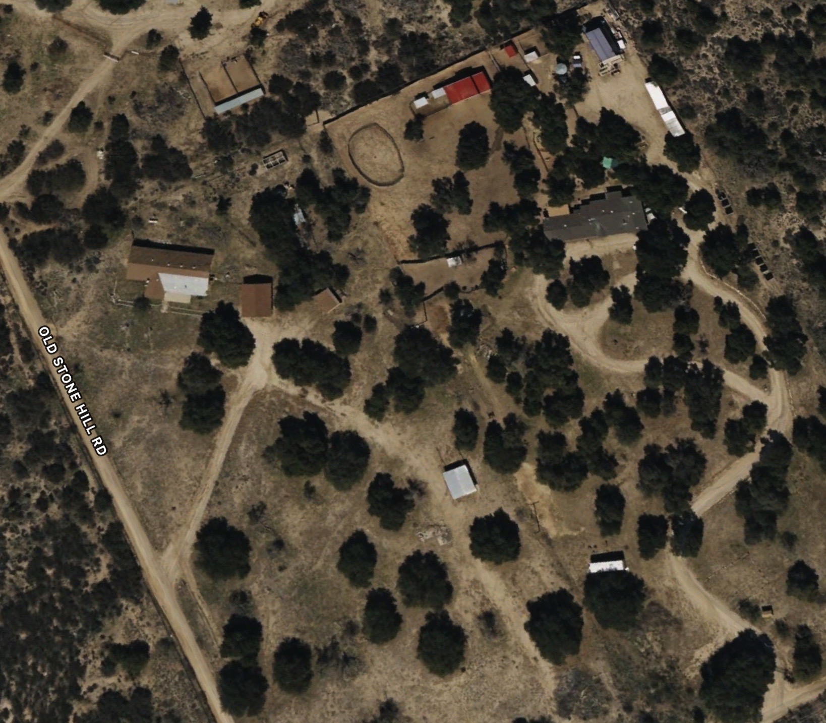
A few weeks later, Anza-Borrego Foundation held only the second bi-monthly board meeting in person, in Borrego Springs, in nearly three years. To reduce my 90-minute commute to the meeting, I rented an Airbnb closer to Borrego Springs, in the Chihuahua Valley of Warner Springs.
Well, the remote location was “closer,” but it only reduced my drive to 60 minutes. This location was also on a mini-farm and the facility was called “The Barn.” I arrived near sunset, driving the last couple of miles on dirt roads.
Here’s an overhead of the location, with the Airbnb at upper right.
And, indeed, it’s a barn.
The upper level is the living space. And the door is pure barn.
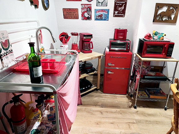
The “kitchen” was spare but functional. I had brought a frozen dinner and was to meet folks for breakfast in Borrego Springs, so the kitchen could be minimal.
Once again, I had farm animals for company. Again, I arrived near sunset and was to leave shortly after sunrise, so I spent a little bit of time checking the animals out before nightfall. Here’s a gallery.
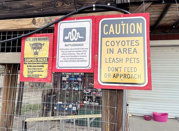
Also, remote as the site was, more than farm animals are about. Several signs warned renters of potential sources of danger.
Leaving the next morning, I drove several miles almost all downhill before I came to a sign indicating the elevation was 3,000 feet. I guesstimate “The Barn” was at an elevation likely in excess of 4,000 feet. That explains why the morning was so “brisk.”
I found both experiences pleasurable and interesting. I do want to get back to the Chihuahua Valley. The landscape is, to me, magnificent. I hope to take future visitors there, too.
I rated both units 5 stars. Neither was the epitome of luxury and comfort, of course, but that’s not what I wanted anyway. These were relatively inexpensive, comfortable, met all my needs, and provided very interesting experiences.
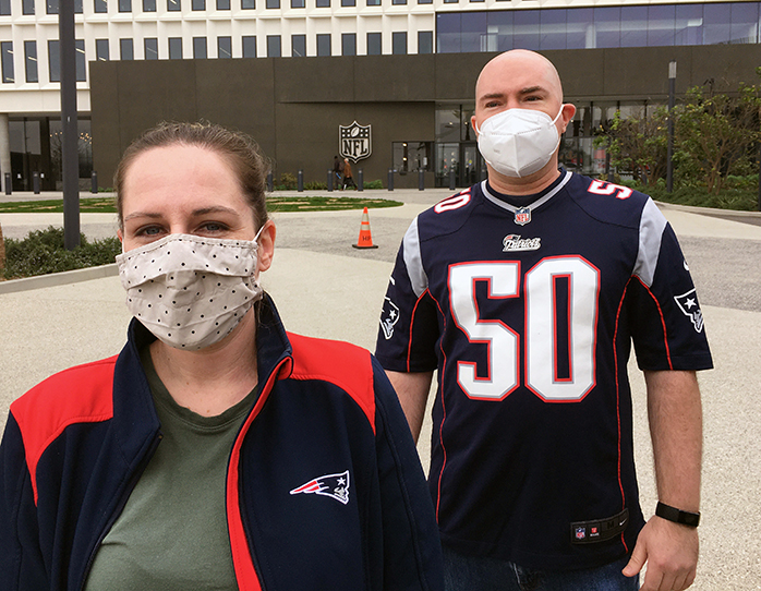
On Halloween Sunday, Meredith, Dillon, and I traveled to LA to attend the Patriots-Chargers game at SoFi Stadium. It was the first NFL game any of us had attended. (I don’t think I can count the AFL Jets-Boston Patriots game I attended in 1963 at Fenway Park. That was pre-merger.)
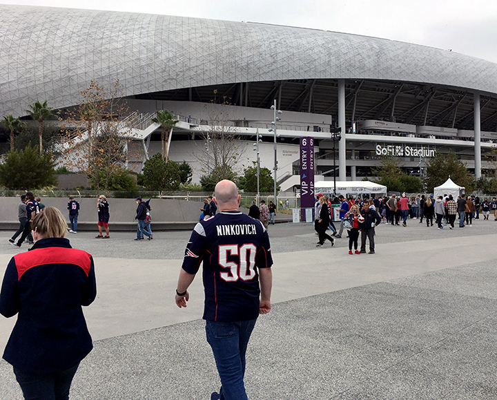
Dillon is an uber-fan of the Pats and Meredith is also a fan, when they’re not playing the Packers. I was most interested, frankly, in the stadium. Pictures of it made it seem pretty futuristic, an engineering/architectural marvel.
Parking at the stadium is sold out, so we went to a parking garage near LAX and took a bus to the stadium. Dillon was wearing a Patriots uniform top and he did not stand out among the several fans on the bus similarly attired. While we waited to board, Meredith chatted with, of course, someone who had moved out here from New Hampshire and also in a Pats jersey.
The stadium was constructed with the field 100 feet below grade and the roof rising to 253 feet, so it is sunken to accommodate the overhead flights paths to and from LAX.
It’s a pretty awesome entrance.
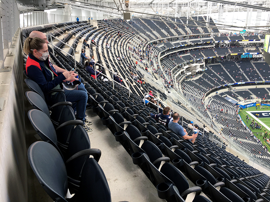
Getting to our seats was a trip. They were literally in the last row. And the section was very steep. I was quite winded getting to them and Meredith experienced some dizziness from the experience. She stayed there for the entire game. When Dillon and I went to get food at halftime, I returned to our seats in “phases.”
Fans of opposing teams nearly always (maybe always) outnumber Chargers fans at home games. Certainly this game was no exception, as Patriots fans were substantially present. In a county with 10 million residents (more than 39 states, including New Jersey, Virginia, and Massachusetts), there are going to be lots of fans of other teams.
When the Chargers took the field, there were loud cheers. When the Patriots appeared, there were very loud cheers.
This video will give you a sense of the difference in grade between external and internal.
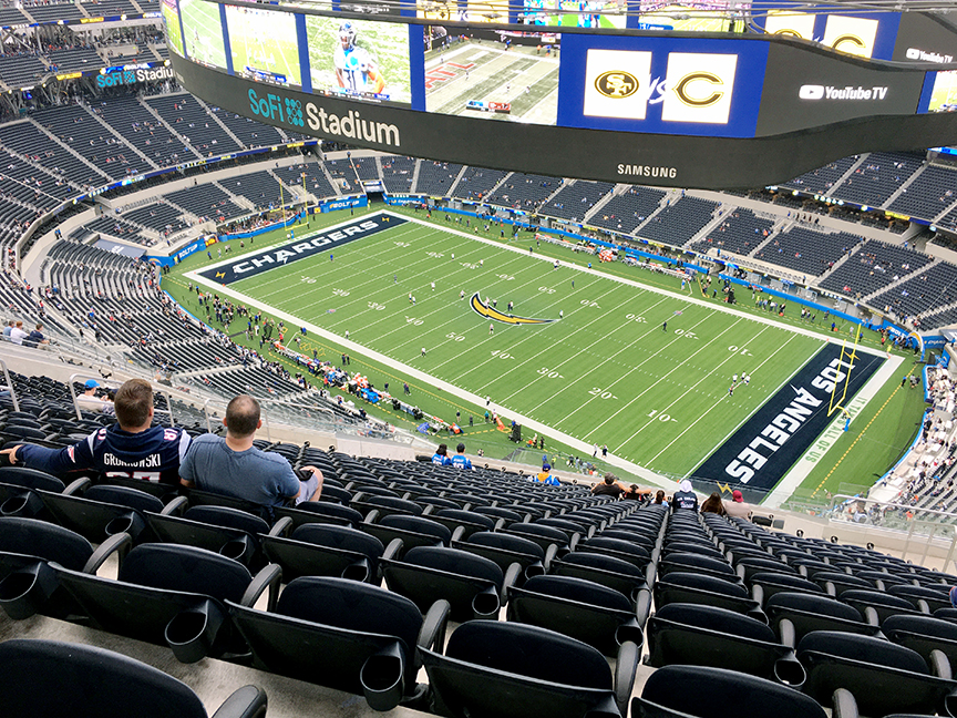
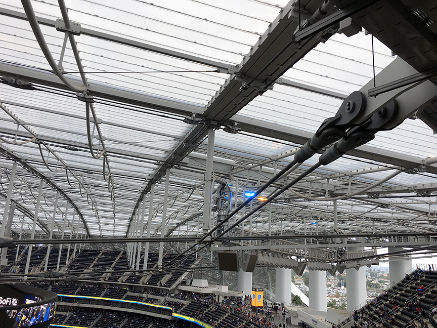
Our seats, with only the ceiling above us, did give us a good view of the stadium’s superstructure and the heavy cables.
The game (oh yeah, the game) was very close, with the Chargers ahead by one point entering the fourth quarter. A pick-six interception and two-point conversion put the Pats up by seven. They added a field goal to lead by 10. A late drive led by Justin Herbert added a touchdown and extra point with 40 seconds to go, but an onside kick was recovered by the Patriots who then ran out the clock.
Overall, the tone of the game, perhaps surprisingly, was defensive. The Patriots gained 352 yards, 210 passing, while the Chargers passed for 206 yards and rushed for an average of eight yards per carry for 163 yards. New England possessed the ball for more than 10 minutes longer than the Chargers and ran 75 plays, compared to 58 by the Chargers.
LA County regulations required wearing masks throughout the game, except when eating and drinking, and on transportation. Many if not most fans dumped the masks during the game.
I’m glad we went to the game, but I have no interest in attending another. Costs too much, everything is too loud, and the fans are too drunk. Professional and major college sports are operated as entertainment more than sport. The only times when there is not very loud sound is when an actual play takes place, but that is comparatively minuscule and the crowd is loud.
The huge screen was helpful, because we could view play and replays closer than from our seats. But it was more an irritant in that it carried ads and promos as well. Also seemed odd that the statistics presented were not of the game, but of fantasy football stats throughout the league. I can’t imagine something more inane than the announcer screaming SECONNNNDDDD DOWNNNNNNNNNN! every time the Chargers made one. The scream came after every down, but that just seemed more inane.
SoFi is to be surrounded by a 300-acre mixed-use development currently under construction. Plans are for up to five million square feet of office space, a retail district of up to 890,000 square feet, 6,000-seat performance venue, 300-room hotel, and up to 2,500 residences. They will border a six-acre artificial lake and 25 acres of public parks and plazas.
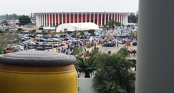
The Forum was once the home of the LA Lakers and the NHL Kings, a sports mecca. They left in 1999 and there are plans to renovate the structure into a concert arena. Opened in late 1967, the structure was also regarded at the time as futuristic. Looks like that not so much in this shot from SoFi. Guess 50+ years will do that to you, says the person who had just turned 21 when the Forum opened.
SoFi Stadium itself contains 3.1 million square feet and can seat 70,240. For events such as a Super Bowl (2022), Olympics, and similar scale events, it can accommodate up to 100,000 fans.
Walking to the stadium, we saw one building already in place — the West Coast headquarters of the National Football League.
Last October, we undertook a few adventures to introduce and reintroduce the Andersons to various aspects of Southern California culture. (A combination of factors led to this presentation being tardy. Sorry.)
First — on October 19 — was “Borrego Days,” a community celebration held by Borrego Springs, situated in the middle of Anza-Borrego Desert State Park. Borrego Springs is 70 miles east and a little south of us. Here’s a video (2:52) showing some of the parade and our time walking around the exhibits in Christmas Circle.
The next day was Fallbrook’s “Harvest Faire,” held “downtown.” Video (4:21) below. Spoiler alert: they each won the costume contest for their age groups!
Balboa Park is San Diego’s central and major park, featuring several museums, gardens, etc. A couple of days following the Harvest Faire, Addy played hookey from school and we all traveled down to see the Park. Here’s video (3:51).
Halloween time around here doesn’t feature the neighborhood trick-or-treating the girls were used to in New Hampshire. But there is another tradition — Dia de los Muertos, “Day of the Dead” — big around here. Celebrated in Mexico and among those of Mexican heritage, it is a multi-day holiday. We attended a one-day celebration at San Luis Rey Mission, 11 miles southwest of us, on October 27. Video (4:41).
(Young women, of course. But “surfer young women” doesn’t quite carry the Beach Boys allusion.)
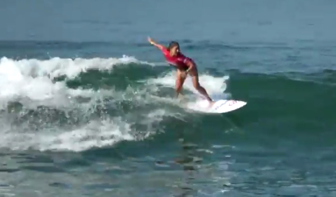
A competitor in the Supergirl Surf Pro event
Back in late July, the Supergirl Surf Pro surfing competition tour came to nearby Oceanside. I showed up somewhat early Sunday morning so that I could get a parking spot. I had tried the previous afternoon and could not find any parking.
The Oceanside event bills itself as “the world’s largest women’s surf event and music festival.” Hard to tell, especially on an early Sunday morning. But this is quintessential SoCal. Surfing alongside an iconic ocean pier with music, booths, an F-16 . . . wait, what? Yes, the Air Force showed up with a pretty large contingent of troops, including a lot of females, even a female brigadier general, and brought along an F-16, for visual effect. It worked.
Unreal, huh? Actually, it is unreal. It’s a composite of two images — the night sky and Borrego Badlands.
Last Friday, I was invited to join a small group going out to Font’s Point, a promontory in Anza-Borrego Desert State Park, to view and photograph the night sky, which features the Milky Way at this time of year.
Leading the excursion were Kati and Ernie Cowan, both professional photographers, among other things (Ernie is president of the Anza-Borrego Foundation [ABF] as well). Also along was Sara Husby, recently named executive director of ABF. A Chicago native, this was Sara’s first trip to Font’s Point, which, along with the night sky, helps explain her enthusiastic response to the scene. 🙂
Below is a short (~2 minutes) video from the excursion. In it, you’ll see both of the scenes in the composite and, as you can tell from the scene highlighted in the video link, an exquisite image of the Milky Way.
 The performance by the Eagles didn’t match the quality of our seats. Tied at halftime, BC didn’t score again and allowed Stanford 10 second half points to give the Cardinal their first win of the year, 30-20.