March 7 was a busy day for me in Borrego Springs. We had an Anza-Borrego Foundation board meeting in the morning and I announced that evening that the 2026 ABF Desert Warrior Award was to the late Nicholas Clapp, former trustee and renowned documentary film-maker.
I presented the award to his widow, Bonnie Clapp, at the beginning of that evening’s performance of Jimmy Smith’s Outrageous Front Porch Revue, an ABF fundraiser, at the Borrego Springs Performing Arts Center. The revue, in its ninth year, offers a great evening of Americana music performed by current and former residents of Borrego Springs. Jimmy Smith is a former long-time trustee of ABF and board president.
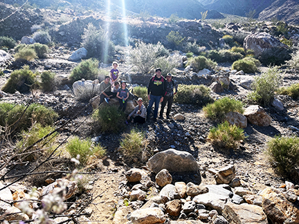
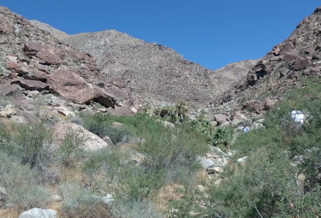
In between the board meeting and performance, I had the opportunity to get out into the desert. ABF board vice president Tim Mielcarek led a group on a three-mile hike (1.5 miles out-and-back) to Henderson Canyon wash. The group included members of the families of board member Elizabeth Latham and of ABF Education Director Samantha Young. Kids hiked and infants were carried.
The hike originated in a section of Galleta Meadows, a privately-owned but publicly-accessible parcel off Henderson Canyon Road, that features several sculptures by the distinctive sculptor Ricardo Breceda.
Heading out.Gold miner and mule
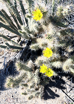
The desert bloom was a bit past peak, but there were many blooms along the way, including the distinctive and fragrant Desert Lily.
I wish I had done a better job photographing this Desert Lily.Cactus blossoms
The objective was the Henderson Canyon wash and, after what seemed farther than a mile-and-a-half, we got there. I should not complain: the terrain was pretty flat and the weather was very pleasant. High temperature around 70, not particularly dry (I even sweat a little).
The wash.Early-arriving hikers in the wash.
As I somewhat trudged on the way back, I marveled at the kids running and leaping among rocks. Ah, youth.
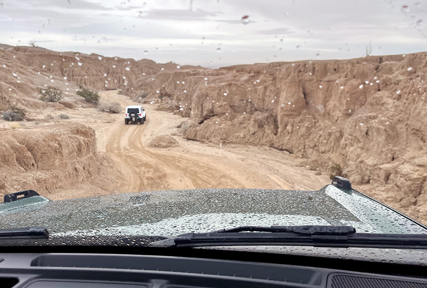
During the afternoon of January 20, I joined a band of fellow board and staff members of the Anza-Borrego Foundation, as well as a few of their kids, on a visit to two popular sites in Anza-Borrego Desert State Park. The first was Vista del Malpais and the other was Coyote Canyon, to check out where the “road” had been washed out there by water brought by recent rains.
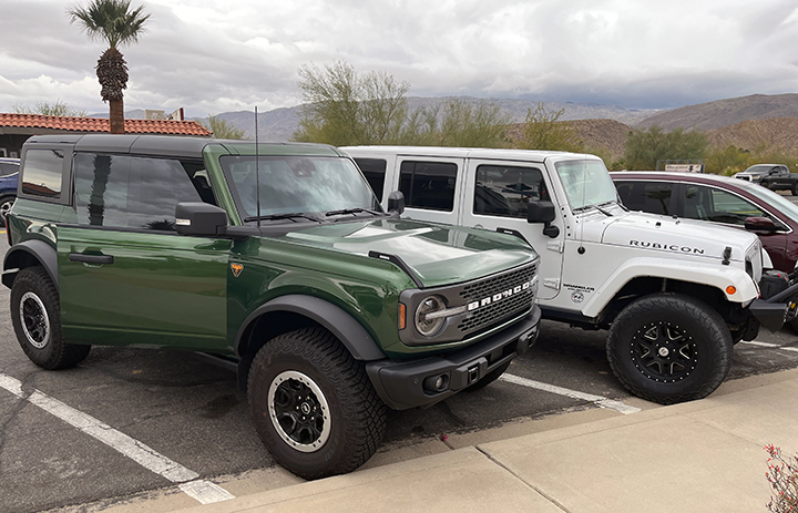
We needed four-wheel off-road vehicles and Paulette Donnellon and Sergey Kushch provided two of the better ones. Paulette had her Jeep Wrangler Rubicon and Sergey had the redesigned Ford Bronco and the appropriately named “Badlands” model. Here they are pre-excursion.
Bronco on the left and Jeep.
Also in the group were board member Stephanie DiPalma and her husband, Tom, in their Jeep Wrangler Sport, and ABF executive director Bri Fordem and board member Maris Brancheau.
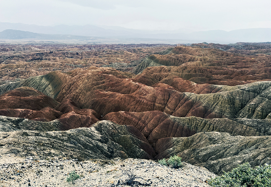
The Vista del Malpais is, as the words themselves convey, where you have a “view of the bad country,” or as commonly used in the West, the badlands. To get there, you have to go through some “not-so-great” lands, in terms of easy travel, anyway. That’s Sergey’s and my view from the Bronco at the top of this post.
We did finally get to the view point and it was definitely worth the trip.
We also saw a few desert lilies, a potential harbringer of what might be widespread flowering of the desert in the spring.
The Coyote Canyon area of Anza-Borrego Desert State Park is about 75,000 acres in size, about a sixth of the Park. It is a deep cut between mountain ranges extending about 10 miles northwest of Borrego Springs. A section of the San Jacinto Fault runs right through the area and it is considered an active seismic zone.
Coyote Canyon is closed to the public June 1-September 30 each year to allow Peninsular Bighorn Sheep access to the creek that runs through the canyon.
When we went, access was closed at the “Third Crossing,” so named because it was the third occasion on the trail where the Coyote Creek could flow over it during the wet season. And it was flowing.
Just off to the side of the “road” and creek was possible evidence of prior and historic seismic activity — a dramatic collection of huge boulders. An adult human would be less than half the height of most of these.
That evening in Borrego Springs, we joined other ABF board and staff members, along with friends and family, at a “Sip & Savor Soirée” wine-tasting event at the Borrego Springs home of Jimmy and Judy Smith. Refined conclusion to a rugged (in a good way) day.
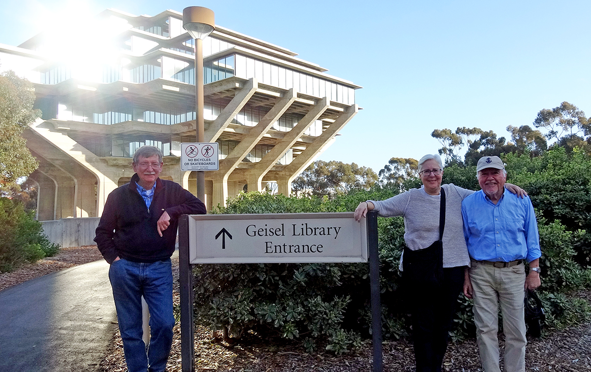
In late February, two dear friends — Larry and Marcy Kenah — visited. They’re residents of Acton, Mass., had gone out to Bend, Ore., to join family celebrating their nephew’s 50th birthday, and decided to venture south.
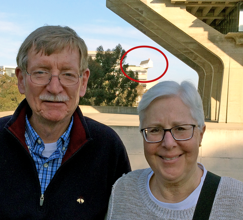
In front of UC San Diego’s Geisel Library.
I picked them up at the airport early afternoon on February 24 and we went for lunch at Stone Brewery Bistro in Liberty Station. I took the “long” way home after that so they could see more of inland San Diego. Our first stop, though, was UC San Diego, to see the Geisel Library there (named for Theodor Geisel, “Dr. Seuss” and a native of my hometown, Springfield, Mass.). It’s one of San Diego’s iconic buildings.
There’s also a bit of surprise behind the library. Here’s a photo of Larry and Marcy with the “surprise” circled.
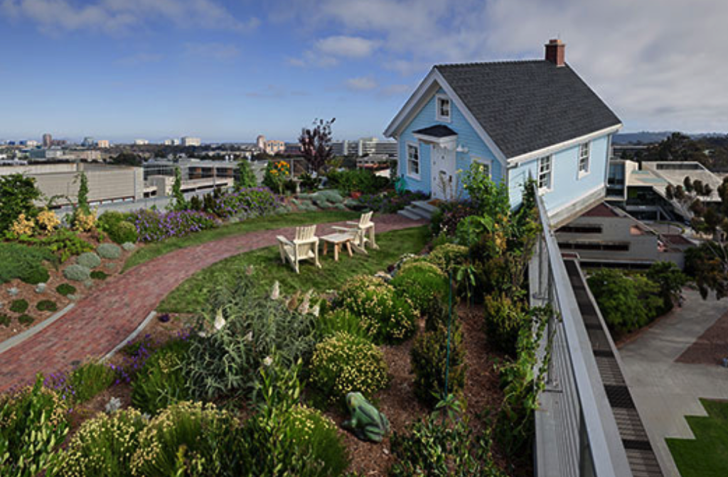
Yes, it’s a house embedded into the corner of a building. Indeed, it is attached to the Jacobs School of Engineering main building. “Fallen Star” is an art installation by South Korean artist Do Ho Suh. The house is fully furnished and has a “yard.” It’s open a couple of days a week for public tours. Here’s a closer view from the UCSD “Fallen Star” website.
Back to more “mundane” matters.
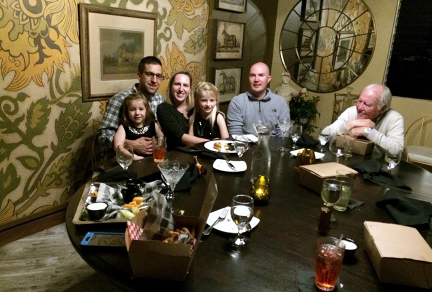
Dinner at Harlow’s. Alice, Winter, Meredith, and Adeline Anderson, Dillon and me.
The Kenahs joined us, including the Andersons and Dillon, for dinner at Harlow’s, a new restaurant in neighboring Bonsall. They spent that night and the next just up the hill from my house in a neighbor’s unit rented through Airbnb. Short walk between us.
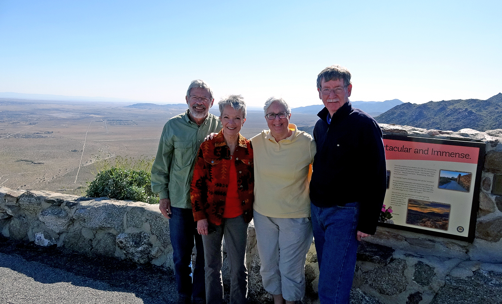
Tuesday was our day in the desert. I had taken Larry out to Anza-Borrego Desert State Park during his visit in 2013 for the BC-USC football game in LA. Though Marcy had originally planned to accompany Larry here then, she decided assisting with a new grandchild was more deserving. She was particularly interested in making the trip to the desert on this visit.
Joining us on the trip were Betty and Wayne White, long-time friends of the Kenahs who live in San Juan Capistrano. As the route they planned to take to the desert brought them only two miles south of my house, we connected with them in Bonsall and caravanned out to Borrego Springs.
First, however, was a stop at Warner Springs to see Eagle Rock. It is a natural rock formation, located on the Pacific Crest Trail, but accessible only via hiking, three+ miles each way from Warner Springs. You can see it, however, ironically to Eagle/BC fans, from Camino San Ignacio. I had hoped we could get through the fence and get closer on foot, but the Vista Irrigation District, which owns the land, seems to have bolstered their barbed wire defenses. From the road, it was somewhat more difficult to discern the shape.
This photo had been taken on an alumni chapter trip to the rock in 2016.
After Warner Springs, we drove down the dramatic Montezuma Grade from Ranchita to Borrego Springs. It’s a drop from 4,065 feet in elevation to 597 feet in 10 miles of severe switchback roads. Here’s a shot of the Kenahs and Whites at an observation point on the grade.
(L-R) Wayne, Betty, Marcy, Larry
We took a brief tour of the community of Borrego Springs, visiting the Anza-Borrego Foundation offices and its State Parks Store, both at The Mall. Then we made a stop at the Serpent Sculpture and drove east to the Badlands. Returning to Borrego Springs for lunch, we then drove out to the Texas Dip and visited Tamarisk Grove, finishing with hikes on the Cactus Loop Trail and Yaqui Well Trail. Here’s video (2:59) of the day in the desert.
Marcy in “the chair” at Stone Bistro.
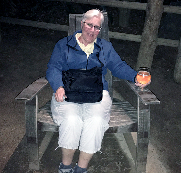
We then headed west to Julian, climbing back up to over 4,20o feet elevation, to make a stop at the Julian Pie Co., for some of their delicious apple pie. The Whites then headed off to the rest of their day and we made our way to the Stone Brewing World Bistro and Gardens in Escondido for a repast. When Larry visited in 2013, we concluded my San-Diego-County-in-a-Day tour there and he sat in one of Stone’s Adirondack chairs holding a cold beer. Since that visit, I have brought each visitor there to have them sit in the “Larry Kenah Commemorative Chair.” It was near dark when we got there this year so the picture of Marcy in “the chair” is less than excellent.
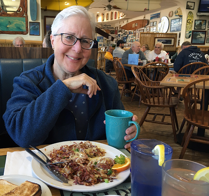
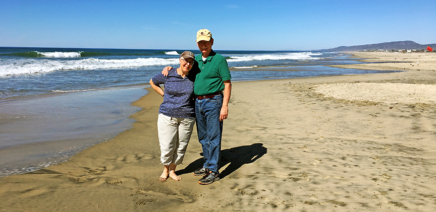
On their last day with me, we started at my favorite breakfast spot — Beach Break Cafe in Oceanside. I have never eaten any thing there other than corned beef hash. Larry and Marcy were sufficiently persuaded by my enthusiasm to order it as well and are now, I believe, fellow enthusiasts.
Oceanside, once a pretty tawdry town infused with off-duty Marines from adjacent Camp Pendleton, has improved by at least several notches. It is still a quintessential SoCal beach town. Beach Break is in “South Oceanside.”
Outside Beach Break, on the Pacific Coast Highway.
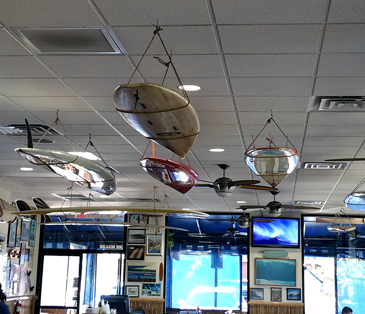
Beach Break does not hold back on its surfer vibe. Surfboards hang from the ceiling and are mounted on walls. Video screens show great surfing rides. The walls are festooned with photos, many autographed by the famous surfers who have visited the restaurant. The oceanic vibe extends to the restrooms as well. Here’s a gallery of shots taken at the restaurant by Marcy.
We then took the short trip to the Oceanside Pier. At 1,942 feet, it is reportedly the West Coast’s longest public pier. We walked maybe halfway along the pier, watching the waves, surfers, and birds. Here’s Larry and me pier side north.
Here’s very brief video (0:24) from the pier.
Just a short hop to Del Mar Beach (not the town) at Camp Pendleton.
It’s about a dozen miles from the coast to Fallbrook and the route is essentially across the width of Camp Pendleton and the adjacent Naval Weapons Station, where taking photos is problematic.
After lunch in “downtown” Fallbrook, the Kenahs took off for the Whites’ home in San Juan Capistrano to finish their SoCal week. As I consistently and perhaps annoyingly reminded them during their visit, “It’s February!”
Last October, we undertook a few adventures to introduce and reintroduce the Andersons to various aspects of Southern California culture. (A combination of factors led to this presentation being tardy. Sorry.)
First — on October 19 — was “Borrego Days,” a community celebration held by Borrego Springs, situated in the middle of Anza-Borrego Desert State Park. Borrego Springs is 70 miles east and a little south of us. Here’s a video (2:52) showing some of the parade and our time walking around the exhibits in Christmas Circle.
The next day was Fallbrook’s “Harvest Faire,” held “downtown.” Video (4:21) below. Spoiler alert: they each won the costume contest for their age groups!
Balboa Park is San Diego’s central and major park, featuring several museums, gardens, etc. A couple of days following the Harvest Faire, Addy played hookey from school and we all traveled down to see the Park. Here’s video (3:51).
Halloween time around here doesn’t feature the neighborhood trick-or-treating the girls were used to in New Hampshire. But there is another tradition — Dia de los Muertos, “Day of the Dead” — big around here. Celebrated in Mexico and among those of Mexican heritage, it is a multi-day holiday. We attended a one-day celebration at San Luis Rey Mission, 11 miles southwest of us, on October 27. Video (4:41).
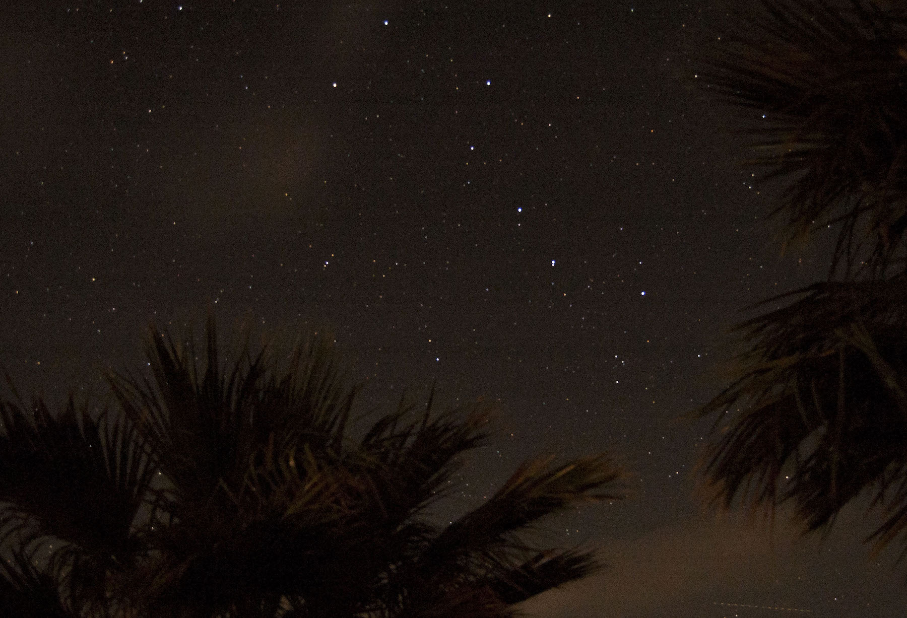
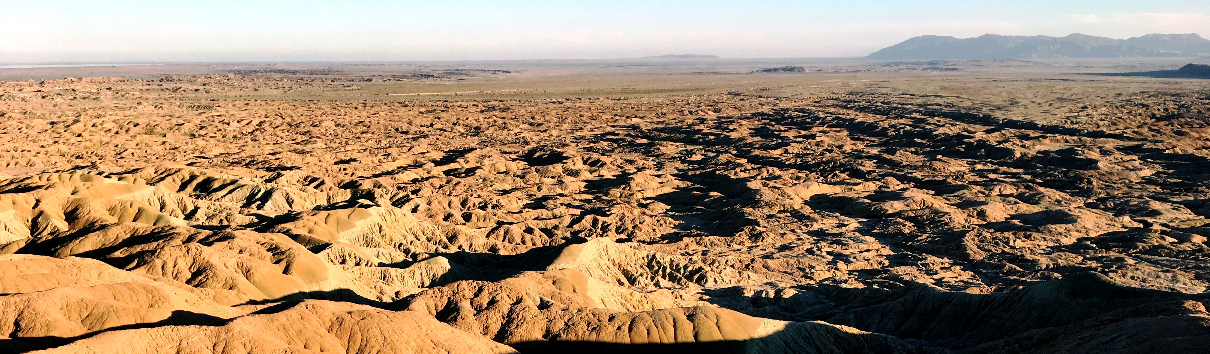
Unreal, huh? Actually, it is unreal. It’s a composite of two images — the night sky and Borrego Badlands.
Last Friday, I was invited to join a small group going out to Font’s Point, a promontory in Anza-Borrego Desert State Park, to view and photograph the night sky, which features the Milky Way at this time of year.
Leading the excursion were Kati and Ernie Cowan, both professional photographers, among other things (Ernie is president of the Anza-Borrego Foundation [ABF] as well). Also along was Sara Husby, recently named executive director of ABF. A Chicago native, this was Sara’s first trip to Font’s Point, which, along with the night sky, helps explain her enthusiastic response to the scene. 🙂
Below is a short (~2 minutes) video from the excursion. In it, you’ll see both of the scenes in the composite and, as you can tell from the scene highlighted in the video link, an exquisite image of the Milky Way.
(Sorry, sometimes I can’t help myself.) Over several years, in all the times I’d visited Anza-Borrego Desert State Park, I had never seen the sheep for which the park is partly named (“lamb” in Spanish is borrego). I first saw a few sheep in March, from afar, as I posted then. In June, on my way home from a board meeting, I saw a ewe atop a crest in the park. Again, from afar.
On Sunday, I joined volunteers helping in the 44th annual Sheep Count at the park. Several dozen volunteers went out to 20 different sites in the park for 2 1/2 days to find and count sheep to help monitor the park’s herd of this endangered subspecies – the Peninsular Desert Bighorn Sheep. Many hiked out each morning to their site, but others backpacked out and stayed at their remote site from Thursday night to Sunday midday. Some sites required hikes of up to six hours to reach them.
The three volunteers I joined had hiked out in the park, observing sheep, on both the Friday and Saturday before, for 10 hours each day. I was the dilettante, coming in for the final day, and a half-day at that.
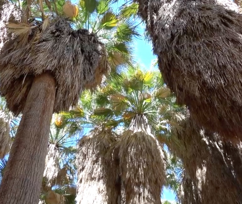
Our location was Borrego Palm Canyon, 1st Grove. The set of palm trees in the center, rear, is the first of three palm groves in the canyon. There were sheep-counters at the second and third groves as well, hours further into the canyon and with no trail.
It took about 45 minutes to hike into the canyon. I was glad that I had a guide with me, because, for periods of time, it was unclear to me where the “trail” was. I had never been out here, though it is the most popular trail in the park, because it is so “easy.” I had a rather naive notion of what an “easy” trail would be like. I was lugging a camp chair, camera equipment (including a tripod), a few containers of water, and more. As you’ll see in the video (of course there’s a video), the trail was at times not flat. (According to my iPhone, for the day, I walked 4.2 miles, taking 12,119 steps, and climbed 13 floors. For some of you, that approaches a normal day. For me, it was very much an outlier. It was in the 80s when we went in around 6:30 am and about 105 coming out midday.)
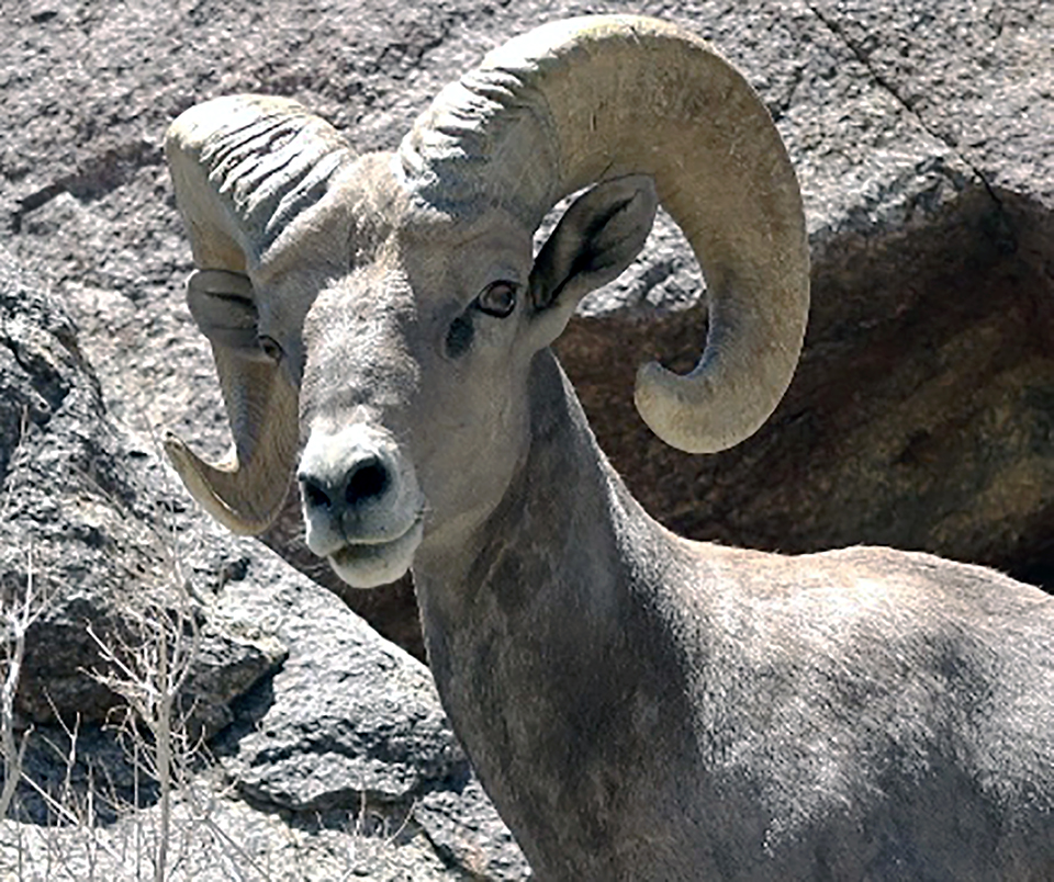
I was told there was no guarantee that I would see any sheep. Several groups of volunteers indeed reported no sightings for the entire weekend. But I hit the jackpot. Not only 15-18 sheep, but some quite close.
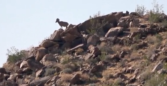
The sheep didn’t start to appear until close to 8 am. The volunteers said they actually seemed to be late sleepers. We had seen hikers in the early morning draw a blank in terms of sheep sightings. Ewes, I was told, usually appeared first and rams followed. This screen capture profiles a solitary ewe near the top of the hillside, but there are several rams below her. I did not see the rams at the time and could discern them only when I watched the video. As you might expect, the sheep blend rather well into their environment.
In one instance, I could have been a YouTube hero . . . and a likely patient in the hospital, if I was lucky. Standing on the trail with another volunteer, we heard sounds from around a curve. My companion said, “Those are not human.” Suddenly, what were hoofsteps were quicker and louder and a ram charged around the corner of the trail, heading right at me. I can still see the headlights of that approaching train, but only in my mind’s eye. I lowered the video camera and jumped off the trail. The ram veered off as well.
Palm Canyon is much more “verdant” than in previous years, because of the above-average rainfall. Hard to imagine, but many of the boulders strewn about the canyon floor had been carried there by massive floods, from centuries, eons ago.
The sheep drink out of rivulets of water that come down from the palm grove (inside view, at left). First Grove contains a pool of water, but the sheep avoid the grove as it provides cover for potential predators, i.e., mountain lions. The sheep seem rather oblivious to people. They are used to them in this canyon, because of its popularity. And there is the thought they realize mountain lions avoid humans, so it is better to be out and about when humans are as well.
This video is less formal than the one I prepared for the Anza-Borrego Foundation. That one contains a bit more on what the counters do and the scientific aspect of the project. I hope you enjoy this view of the sheep and their world. (I recommend watching on your device with the biggest screen, not a phone.)
I’ve spent more time than usual out in the desert, enjoying a wildflower bloom that is the best in more than a decade and, in a small way, helping out with serving the large numbers of visitors. I’ve posted earlier about it and have some more to share.
The weekend of April 1, I was in Borrego Springs for an Anza-Borrego Foundation board meeting and to celebrate ABF’s 50th anniversary. I arrived on March 31 and stayed the night, having my first opportunity to see the dark sky without a full moon to “interfere.” This is a shot from around 9 pm. I hope to return in the summer when the Milky Way is visible.
The morning of April 1, ABF President Ernie Cowan – noted birder, outdoorsman, photographer, and writer – took me out to Plum Canyon for flowers and to Tamarisk Grove to see a nocturnal bird of prey, which was still up but a bit secluded. Here’s a brief (< 3 minutes) video of the morning.
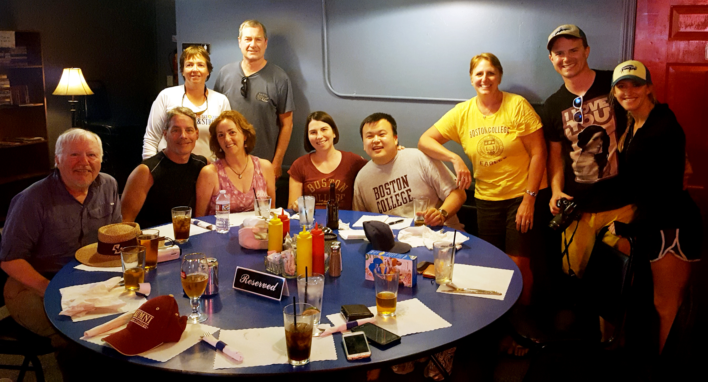
Spent a couple of days recently again out in Anza-Borrego Desert State Park, leading a group of local BC alumni on a tour March 18 and later, on Friday, to help out serving all the visitors coming to the Park for the best wildflower blooms this century – a “flowergeddon.”
This is a brief video of some of the highlights of the tour with BC alumni.
We spent the morning traipsing about and got together for lunch at a Borrego Springs roadhouse.
Seated, l-r: Bill McDonald ’68, Mike Scott, Mary Ann Scott ’75, Lissa Tsu ’00, Brian Tsu ’00; standing, l-r: Mary Berube ’80, Ray Berube ’78, Jania Andreotti ’85, Pat Ahern ’11, Meryl Evangelista.
Returning last week to help out, I was chagrined when a visitor arrived at my wildflower info table and said he was already fully satisfied with his visit, because he had seen bighorn sheep. Hmmmph! In all the times I had been out to the desert, I had not seen the sheep for whom the Park is partially named (borrego in Spanish means lamb). He mentioned he had seen them while he was driving down the Montezuma grade, a dramatic ride (to which Larry Kenah, Ed Hattauer, and others can attest) from 4,000-feet elevation to the desert floor, switchback road all the way.
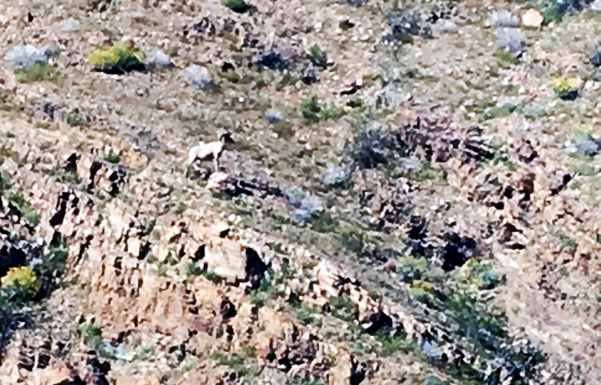
A hour or so later, I was driving up the Montezuma grad heading home when I noticed a number of cars pulled to the side of the road and people looking up into the hillside. Borrego? I joined them and, for my first time, saw the bighorn sheep. I immediately regretted that I had not brought my Nikon camera or Sony camcorder to capture the images. What you see is what my iPhone caught, grainy because of the sheep’s distance from me. When I get better images, I will provide.
This one sheep was captured taking a pose majestically on a rock. Two others later joined the first and, rather than try for a photo I knew would also be blurry, I just enjoyed their perambling.
To my left, I saw another borrego and then a companion to the first. They’re on the ridgeline.
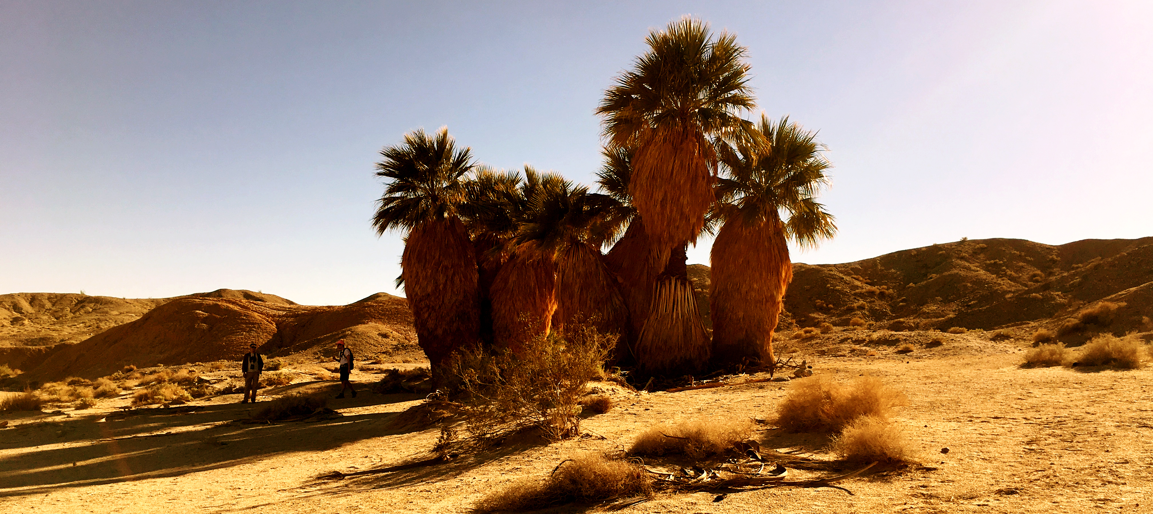
I had the pleasure Saturday to visit an oasis in the badlands of Anza-Borrego Desert State Park. Anza-Borrego Foundation sponsored a tour for members of the ABF’s Century Circle, major donors to the foundation, and I was able to join the tour.
In a caravan of four-wheel-drive vehicles, the two dozen+ participants first visited 17 Palms Oasis, 15-20 miles east of “downtown” Borrego Springs, near the eastern edge of the park. This is a naturally occurring collection of California fan palms, the only palm tree native to the western United States. The name is based on the number of palm trees present, though that number has fluctuated through the years. At least a couple of people counted 18 palms. Other oases in the park are called 5 Palms and Una Palma.
The palms exist there because conditions permit it. They are close to a wash, so water from occasional and sometimes heavy rains can nourish them. Water as well exists in aquifers beneath them.
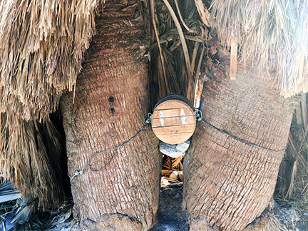
The “desert mailbox” at 17 Palms
These oases are the proverbial water holes that sustain animal life and, in years and millenia past, humans. Attracting travelers, the oasis also was a variant of a post office. A “desert mailbox” has been located at 17 Palms since the late 1800s. People could leave letters and messages in it, requesting that someone passing through carry it to its destination or to a closer “desert mailbox.” The current such mailbox, wedged between two palms, holds journals in which visitors to the oasis can leave comments and thoughts.
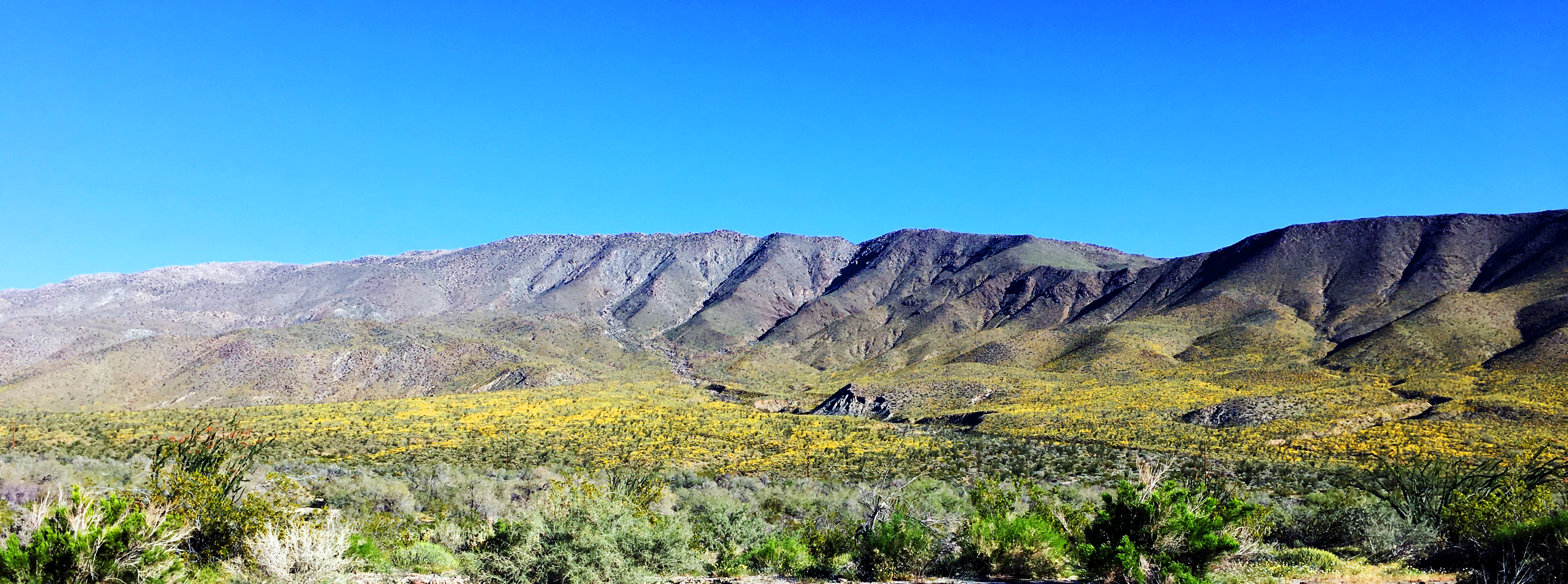
Later, we moved on to Vista del Malpais. “Mailpais” is Spanish for “badland.” From this vantage point, one can look out for miles over the badlands. Here are two such views.
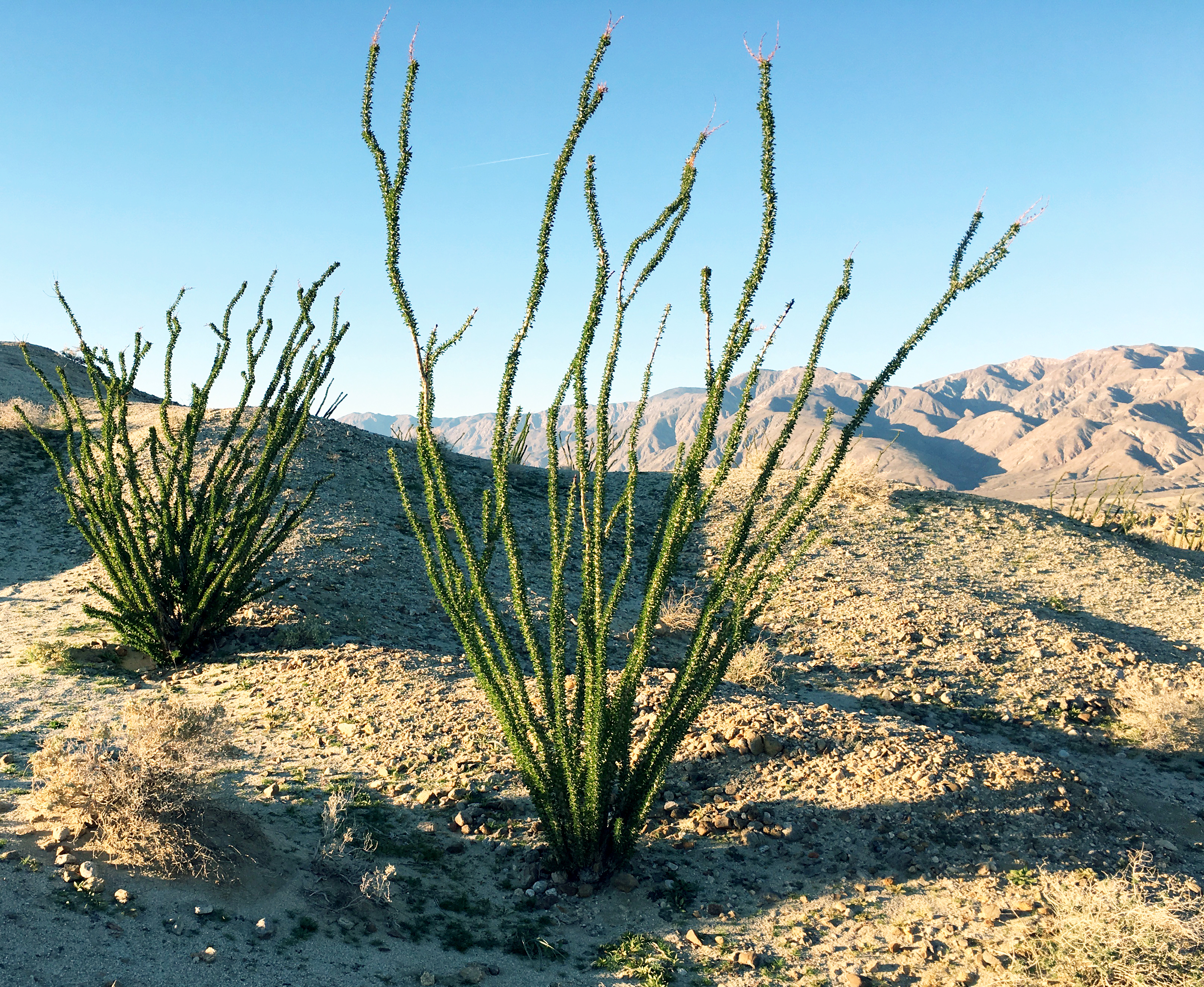
Of course, even near the badlands, there can be vegetation. These ocotillos were at Vista del Malpais.
There are expectations for a great desert wildflower season in the spring. Crossing our fingers!
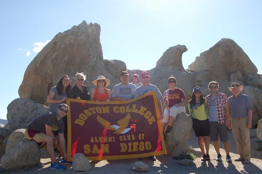
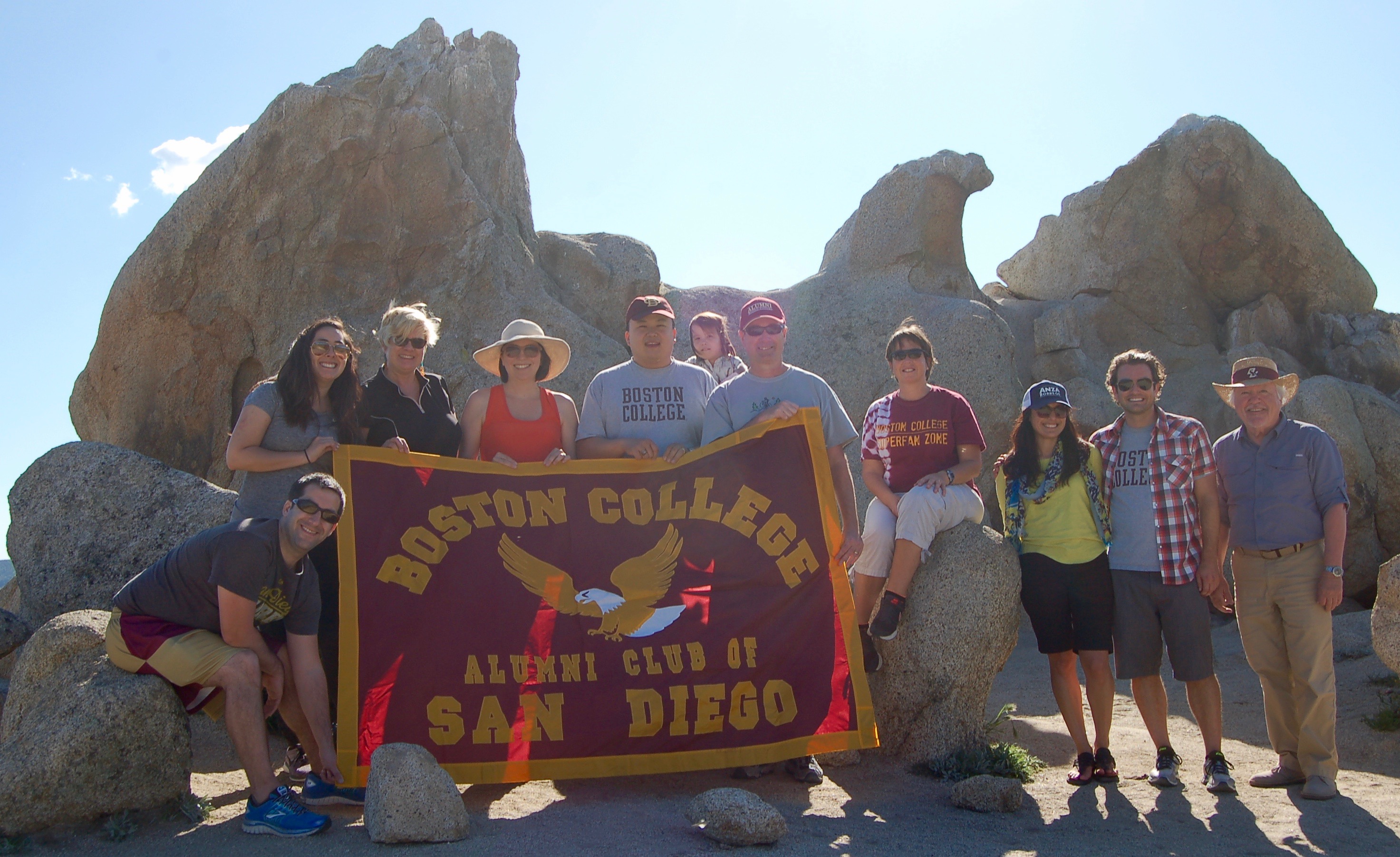
BC alumni and friends at Eagle Rock, Warner Springs. L-R: Mike Ross ’09, Marissa Robles, Rebecca Scease Reid ’96, Lissa Herrick Tsu ’00, Brian Tsu ’00, Margot Tsu, Ray Berube ’78, Mary Farrell Berube ’80, Janet Rodriguez, Kevin Smosky ’00, Bill McDonald ’68.
There is a natural rock formation in Warner Springs, about 90 miles northeast of downtown San Diego, that looks a little like an eagle. Actually, as you can see above, the rather large natural rock formation looks like nothing else than a big eagle.
In early April (I’m way behind on posts), 10 alumni and friends (and a young daughter) made the trek to Eagle Rock, which is located on the Pacific Crest Trail. In a pretty weird connection, we accessed the area where Eagle Rock is located from Camino San Ignacio in Warner Springs. That’s “St. Ignatius Road.” !?
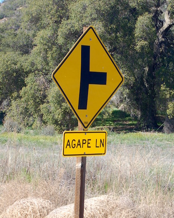
And a few miles down the road on State Route 79 is a street with another Jesuit-related name (see photo at right). Anyone know about any Jesuit presence in northeast San Diego County?
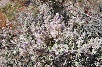
We also went further initially than Warner Springs, over the mountainsides to Anza-Borrego Desert State Park. Desert flowers are somewhat past peak (earlier and briefer than expected in this El Niño year), but there is still some color not seen the rest of the year.
Our flower guide was Christina St. John from the Anza-Borrego Foundation. About to pursue a master’s degree in botany, Christina was an invaluable guide to the desert flora, as well as a friendly companion. With her guidance, we visited Glorietta Canyon, one of the most accessible areas of the Park (though over a couple of miles of dirt road) and location of many flowering plants in the spring.
It was pretty much a day-long excursion, also including lunch in Borrego Springs, and a visit to a rather unusual piece of “public art.” Below is a short (<5 minutes) video of the day, including the desert flowers, etc. You’ll see that we were able to visit Eagle Rock and park our cars inside the gate that warns “No Trespassing.” That’s because we had received official permission from the Vista Irrigation District to do so, after filling out various waivers, and were on the property for only about a half-hour. We had some unexpected companions on our visit to Eagle Rock, examples of the “wildlife” in the area . . . but that’s for you to see. (Click on “BCSD @ Eagle Rock” at upper left of graphic below to watch on YouTube. Much better viewing.)